What is recorded here
Two stones stood in J. J. Cronin's farm, one recumbent and one tall enough to cast a long shadow, yet their exact location has slipped from human memory. They may have marked a boundary, a burial, or a place where people gathered before roads and fields took shape. Forgetting does not erase them; it returns them to the land, where stone keeps what witness releases.
Bowman (1934, 300) recorded two standing stones in J. J. Cronin's farm; 'c. 15 yards E of church site (14403). (a) recumbent, 4ft by 2ft by c. 11/2ft. (b) 27ft West of (a) 3ft by 13ft 9in girth. Exact location not known.
The above description is derived from the published 'Archaeological Inventory of County Cork. Volume 4: North Cork' (Dublin: Stationery Office, 2000). In certain instances the entries have been revised and updated in the light of recent research.
Date of upload/revision: 14 January 2009
The monument record does not grant public access. Check the route and ask the landowner before entering private land.
- What survives
- Recorded monument
Places near here
 Church (Site of)Church · 742 yd
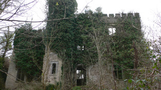 Duarrigle Castlecountry house · 1588 yd
 IndicatedKiln, lime · 1616 yd
 Dromsicane Castle (in Ruins)Bawn · 1714 yd
 Fulacht Fiadh (Site of)Fulacht fia · 1.0 mi
 Castle and TurretCastle, tower house · 1.8 mi
 Millstreet Tourist InformationVisitor information · 2.6 mi
 Millstreet Museum & Tourist Information CentreMuseum · 2.6 mi
 Claragh Loop (Trailhead 99)Visitor information · 2.6 mi
 Claragh MountainMountain / peak · 3.5 mi
 RowanRowan · 3.5 mi
 Rathcool WoodWood · 3.9 mi