
What is recorded here
Situated on a rise on the N side of the floodplain of the W-E Blackwater River and at the base of a steep S-facing slope. The site of the parish church of Mocollop which was united with Lismore by the 17th century. The united parish was almost co-extensive with the barony of Coshmore and Coshbride, extending as far S as the River Bride and E to the Glenshelane River.
The E wall (Wth 1m; H 0.1m;) and traces of the N and S walls of the church (int. dims 5.8m N-S; at least 7m E-W) are just S of the abandoned C of I church. The headstone (max. H 1.25m; Wth 0.8-0.85m) of Richard Norris, dated 1629, is at the centre of the rectangular graveyard (dims. c. 65m E-W; c. 40m N-S) defined by a masonry wall. Mocollop Castle (WA019-003----) is c. 300m to the S. (Power 1898a, 216)
Power, Rev. P. (1898a) Ancient ruined churches of Co. Waterford, WAJ 4, 83-95, 195-219.
The above description is derived from the published 'Archaeological Inventory of County Waterford' (Dublin: Stationery Office, 1999). In certain instances the entries have been revised and updated in the light of recent research.
Revised by: Michael Moore
Date of upload: 16 February 2011
St. Mary's Church in Mocollop was likely built in the 17th century, dedicated to St. Mary, and reflects the ecclesiastical unification of Mocollop with Lismore. Its location on a prominent rise suggests strategic and spiritual significance within the local landscape.
The monument record does not grant public access. Check the route and ask the landowner before entering private land.
- What survives
- Recorded monument
Places near here
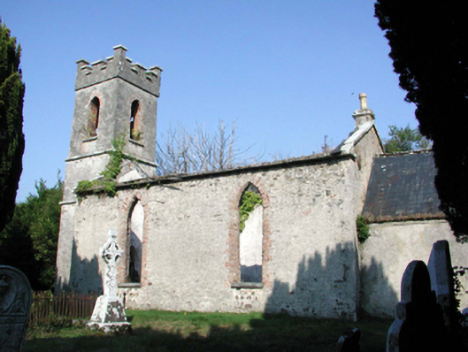 Saint Mary's Church (Lismore and Mocollop)church/chapel · 10 yd
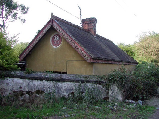 Mocollop Castlegate lodge · 112 yd
 Mocollop Picnic SitePicnic place · 258 yd
 Mocollop Castle (in ruins)Castle, Anglo-Norman masonry castle · 324 yd
 IndicatedEnclosure · 1.6 mi
 Fulacht fia in CoolbaunFulacht fia · 1.7 mi
 Saint Micheal's Holy WellSpring · 2.1 mi
 Sheanmore Castle (in ruins)Castle, tower house · 2.3 mi
 KnocknaloughMountain / peak · 2.5 mi
 KnockadullaunMountain / peak · 3.4 mi
 Natural heritage of CoolagowanVisitor information · 3.9 mi
 Graveyard in Curraheen (kinnatalloon By.)Graveyard · 4.0 mi
Other information
Photo: Credit not shown in the picture search · Rights wording not checked; contact us if this picture should be removed