
What is recorded here
William de Burgo probably founded the Premonstratensian abbey near Tuam in 1203, placing white-robed canons beside a dangerous, flooding pasture. They chanted, farmed and died there until Archdeacon Burton stripped its stones in 1791 for a private house. Now residential walls and gardens cover the abbey, yet a small plaque and a nearby holy well preserve the shape of what was taken.
On W outskirts of Tuam town (GA029-199----) in low-lying pasture prone to flooding, its site is now occupied by a housing estate. This abbey, a daughter house of the Premonstratensian Canons, was probably founded c. 1203-4 by William de Burgo (Gwynn and Hadcock 1970, 206-7). Described in the early 13th C as being situated 'in the suburbs of the metropolis of Tuam' (ibid.). According to OS Letters (O'Flanagan 1927, Vol. 1, 62-3), 'a considerable part of it remained till the year 1791, when Archdeacon Burton carried off the stones for the building of a house'. Depicted on James Morris's 1720 map of Tuam as a H-shaped building aligned N-S. The 3rd ed. of OS 6-inch map (1932) indicates an oblong mound (WNW-ESE c. 45m, NNE-SSW c. 25m), but this appears to have been destroyed by road building and house construction in the mid-1970s during which time human remains were unearthed (Ó Murchú 1970, 13-14). A commemorative roadside plaque marks the site. A holy well (GA029-177----) lies 100m to NNE.
The above description is derived from the published 'Archaeological Inventory of County Galway Vol. II - North Galway'. Compiled by Olive Alcock, Kathy de hÓra and Paul Gosling (Dublin: Stationery Office, 1999).
Date of upload: 05 August 2010
The Abbey of the Holy Trinity in Townparks was founded c. 1203 by the Premonstratensian Canons as a daughter house, and it is significant as a medieval religious establishment in the Tuam area. Its site, now part of a housing estate, reflects the region's monastic and ecclesiastical history.
The monument record does not grant public access. Check the route and ask the landowner before entering private land.
- What survives
- Recorded monument
Places near here
 Abbey WellHoly well · 108 yd
 Saint Mary's Cathedralcathedral · 113 yd
 Part of St. Jarlaths CrossCross, High cross · 116 yd
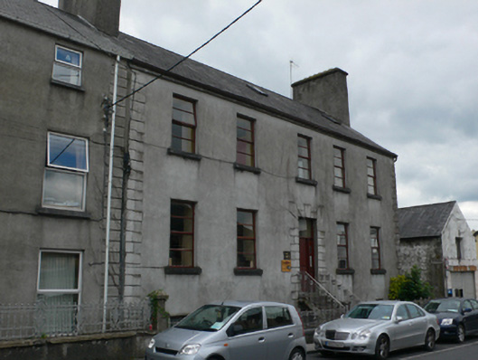 Mall Househouse · 278 yd
 CastleCastle, unclassified · 409 yd
 European ashEuropean ash · 2.3 mi
 Mass RockNamed rock · 3.3 mi
 Ballinderry CastleCastle, tower house · 3.6 mi
 KnockmaaWood · 5.0 mi
 Kilcoona Round TowerHeritage attraction · 8.7 mi
 Ballinduff BayBay · 11 mi
 Oileán an AoilIsland · 13 mi
Other information
Photo: Credit not shown in the picture search · Rights wording not checked; contact us if this picture should be removed