
What is recorded here
Killygordon castle stood beside the River Finn as an O'Donnell stronghold before Manus O'Donnell lost it to an English force during the rebellion of James I. Captain Ralph Mansfield received the estate, built a three-storey house and bawn there, and turned the river passage into a useful royal outpost. The castle itself has vanished, but his family line and the house nearby still mark the place where conquest became settlement.
The Ordnance Survey Memoirs recorded in 1836 that, 'The site of another castle belonging to the O'Donnells is still shown in the townland of Killygordon, near the left bank of the River Finn at a place called Lower farm. In the reign of James I, Manus O'Donnell (brother to Earl O'Donnell of Donegal), who then held this castle being in the rebellion, an English force was sent against him and in a few days he and his adherents dispersed. An English officer named Mansfield having greatly distinguished himself on this occasion, the king granted the castle and estate called the estate of Killygordon to him and his heirs, by whom it is still possessed' (Day 1997, 34). The site of this 'Castle' is marked on the 1st edition of the OS 6-inch map beside the River Finn; no visible trace survives. Capt Ralph Mansfield, who had been granted 1,000 acres in the barony of Raphoe in 1610, had built a three-storey house and bawn (DG078-029002-) here by 1619, though the house was then unslated. It had been completed by 1622 and was inhabited by his son's wife and family (Hill 1877, 272-3, 517; Treadwell 1953-5, 516). In 1618/19 Nicholas Pynnar recorded that 'Upon this Proportion the Bawne (DG078-029002-), and a good Stone House three Stories high is ready to be slated, himself with his family there dwelling; and near to this place he hath made a Village, consisting of 9 Houses, and standing on a Passage very commodious for the King's service' (Hill 1877, 517). Killygordon House (DG078-023003-) is located 990m N of the medieval castle site and 350m E of the village of Killygordon. Rowan (1979, 333) says that Killygordon House was built in 1652, but a tradition records that it also was built by the Mansfields. It is possible that the 'castle' beside the river dates from the medieval period and that the 17th century house and bawn built by Captain Ralph Mansfield was constructed on the site of the house indicated on the first edition of the OS six-inch map as Killygordon Demesne (DG078-023003-).
The above description was derived from the 'Archaeological Survey of County Donegal. A description of the field antiquities of the County from the Mesolithic Period to the 17th century.' Compiled by: Brian Lacey with Eamon Cody, Claire Cotter, Judy Cuppage, Noel Dunne, Vincent Hurley, Celie O'Rahilly, Paul Walsh and Seán Ó Nualláin (Lifford: Donegal County Council, 1983). In certain instances the entries have been revised and updated.
Compiled by Caimin O'Brien
Date of upload/revision: 15 November 2011
The castle at Killygordon was held by the O'Donnell dynasty in the 16th or 17th century. It is remembered as part of the historical network of Gaelic lordships in western Ulster.
This remains an important historical record, but the official description says the monument is no longer visible or has been destroyed. The monument record does not grant public access. Check the route and ask the landowner before entering private land.
- What survives
- No visible remains or recorded as destroyed
Places near here
 Killygordon Bridgebridge · 283 yd
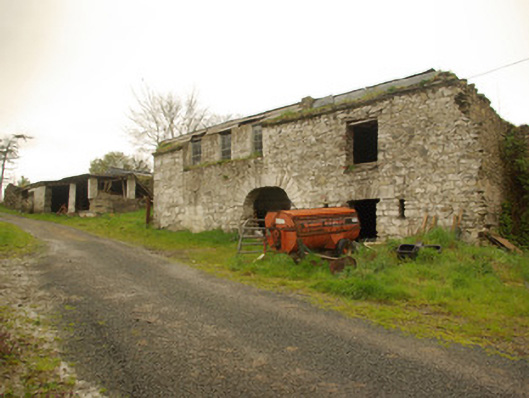 Killygordon Houseoutbuilding · 983 yd
 Enclosure in CarricknamannaEnclosure · 1.6 mi
 Castle (Site of)Castle, unclassified · 2.0 mi
 Enclosure in DrumavishEnclosure · 2.2 mi
 CastleCastle, unclassified · 3.5 mi
 Carnowen HillMountain / peak · 3.7 mi
 Drumboe WoodForest recreation place · 4.0 mi
 Lismullyduff MountainMountain / peak · 4.1 mi
 Killeter ForestForest · 10 mi
 Newmills Corn and Flax MillsHeritage attraction · 11 mi
 Battle of Scarrifholisbattle · 11 mi
Other information
Photo: Credit not shown in the picture search · Rights wording not checked; contact us if this picture should be removed