
What is recorded here
Possible medieval settlement near the SE corner of Fenit Island associated with an old mill site has not been located. Folklore collected from Chapeltown (Baile na hEaglaise) School recorded the following tradition; ' In ancient times two large villages were in Fenit Island - one in the west [KE028-096----] in a place called Cuan [harbour] Garsons [?] and another in the east near where the old mill [KE028-0897001-] is indicated on the map. No trace of these exists today only the ruins which are occasionally turned up by the plough. The Teampaillín [KE028-023001-] would thus be centrally situated between both villages' (The Schools’ Collection, Volume 0438, Page 271; https://www.duchas.ie/en/cbes/4706321/4702383).
A second story collected from Chapeltown School recorded details about the mill and the associated settlement on Fenit Island; 'At the South-east corner of the Island I was told there once was a mill for grinding corn. It is marked on the enclosed sketch-map, no trace of it exists today. I was told by John Slattery in whose land the mill was that the driving power was the sea-water which was trapped at high-water in Spring-tide on this low beach and the mill wheel was turned by the escaping water as the tide went out. There once was a big village at this part of the island as the owner of the land often met with foundations of houses and lots of cockle-shell dumps in this area. About 100yds [91m] from where the village stood is a spring well about 8ft [2.4m] deep which supplied them with water. An old Bittling stone still stands at the [well?]' (The Schools’ Collection, Volume 0438, Page 268; https://www.duchas.ie/en/cbes/4706321/4702380/4724473?ChapterID=4706321).
Earthworks of a field system and cultivation ridges visible on Digital Globe orthoimage taken between 2011-13 and on Google Earth orthoimages may be the remains of the deserted village described above located on on the SE side of the island.
See attached sketch map of Island showing the location of the mill (The Schools’ Collection, Volume 0438, Page 259), Image and data © National Folklore Collection, UCD.
See attached Google Earth orthoimages
Compiled by: Caimin O'Brien
Date of upload: 14 June 2022
The monument record does not grant public access. Check the route and ask the landowner before entering private land.
- What survives
- Recorded monument
Places near here
 Chapel in Fenit WithinChapel · 541 yd
 Fenit Castle (in ruins)Castle, tower house · 657 yd
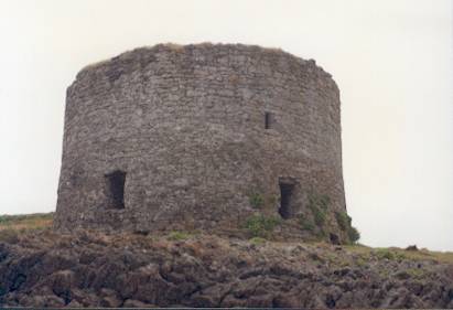 Barrow Round Castle (in ruins)Castle, tower house · 889 yd
 Barrow Househouse · 1309 yd
 Enclosure in BarrowEnclosure · 1640 yd
 Enclosure in Fenit WithoutEnclosure · 1.1 mi
 Fenit BeachBeach / strand · 1.4 mi
 Tralee BayBay · 1.5 mi
 CloghnacroustaNamed rock · 1.6 mi
 Samphire IslandIslet · 1.7 mi
 Saint BrendanMemorial · 1.8 mi
 Samphire Island LittleIslet · 1.8 mi
Other information
Photo: Credit not shown in the picture search · Rights wording not checked; contact us if this picture should be removed