
More pictures of this place

![I took this photograph using a telephoto lens and it presents a very compressed view of Limerick City centre. The photograph includes Sarsfield Bridge and the two tallest buildings in the city. According to some accounts there has been notable modern architectural developments and improvements in the appearance of Limerick city centre in recent years. Much of the development has been along the banks of the river Shannon. The most prominent structures are the 60m high Riverpoint building and the 200 ft Clarion Hotel on Steamboat quay. The Clarion is a 17 storey hotel located beside the River Shannon on Steamboat Quay in Limerick. The Hotel was built in 2002 at a cost of €20 Million. Due to its proximity to Thomond Park, a lot of opposing rugby teams stay here when they play Munster at the stadium. Riverpoint is a two tower mixed-use building. Standing at 58.52 metres (192.0 ft)it is currently the fourth tallest building in Ireland. The Riverpoint Tower is 5.52 m (18.1 ft) taller than the nearby Clarion Hotel Limerick. The Riverpoint development as a whole forms most of the block surrounded by Henry Street (N20), Lower Mallow Street, Russell's Quay and Mill Lane. The only other buildings on the site are an apartment building on the corner of Lower Mallow Street and Henry Street, and the Eircom building on Henry Street. I took some photographs near the Clarion Hotel and thought that the area showed all the signs of urban decline and next door to the hotel was a huge pile of what looked like rubble, infill or scrap metal and there was a convoy of five large trucks awaiting entry to the site [which I assume is part of the docklands] beside the hotel. Not far away from Riverpoint is Radio House and next door to this building is another derelict site which may have been a petrol station at some stage. Across the street from Riverpoint is a work of public art “The Broken Heart” which is badly maintained. The current Google Earth view is out of date and does not show the real improvements that have been made along Bishop’s Quay, Howley’s Quay and Harveys’s Quay.](https://upload.wikimedia.org/wikipedia/commons/4/46/A_COMPRESSED_VIEW_OF_LIMERICK_CITY_CENTRE_%2814217857327%29.jpg?utm_source=commons.wikimedia.org&utm_campaign=imageinfo&utm_content=original)
What is recorded here
Look past the walls and into what happened here. This fine bridge contributes to an outstanding view which includes the Shannon Rowing Club, and in the distance the Court House, Saint Mary's Cathedral and King John's Castle.
Five-span limestone road bridge, built between 1824-35, spanning the River Shannon joining Sarsfield Street and Ennis Road on a southeast/northwest axis, splaying to both sides to form abutments at the junction with the Ennis Road. Span adjoining Sarsfield Street forming a steel swivel bridge, put in place in 1923, replacing an earlier swivel bridge. Parapet reconstructed c. 1975, comprising balustraded east parapet with limestone ashlar piers over bowed cutwaters, and largely solid limestone ashlars west parapet with intermediary balustraded sections. Squared and coursed tooled limestone ashlar bridge with carved profiled saddle-backed coping. Recessed panel corresponding to each limestone cutwater. Cast-iron lamp standards surmount parapet to each side. Three commemorative panels to parapet piers, one reads: 'This bridge was erected A.D. 1831 under and Act of the IV George IV: introduced into Parliament by the Right Honorable T. Spring Rice M.P. for the city of Limerick.' A second plaque reads: 'Sarsfield Bridge by authority of Parliament and through liberal grants from the Grand Juries of Limerick and Clare Alderman Jerome Counihan J.P. Mayor of Limerick 1882-1883. Was enabled to declare this bridge free of toll on Easter Monday 26 March 1883 William Boyd J.P. High Sheriff Alfred G. Wallace Sol. Town Clerk.' A third plaque reads: '1975 European Architectural Heritage Year parapets reconstructed Alderman Patrick Kennedy Mayor James Tully T.D. Minister for Local Government.' Tooled limestone ashlar voussoirs to elliptical arches, each springing from a pier with rounded cutwaters with distinctive clam-shaped limestone capping.
This fine bridge contributes to an outstanding view which includes the Shannon Rowing Club, and in the distance the Court House, Saint Mary's Cathedral and King John's Castle.
The Limerick Bridge Commissioners were incorporated for the purpose of erecting Sarsfield Bridge (Wellesley Bridge) and a floating dock under the Act of 1823 entitled 'An Act for the erection of a bridge across the River Shannon and of a floating dock to accommodate sharp vessels frequenting the port of Limerick'. Built to the designs of the great Scottish engineer Alexander Nimmo (1783-1832) between 1823-35, it was completed by John Grantham in 1835. The foundation stone was laid on the 25th October 1824 and the bridge was opened 5th August 1835, with a cost of £89,061. The design of the bridge is based on Pont Neuilly in Paris. Each span reaches 70 feet, with each arch rising to a height of 8 feet 6 inches. The contractor was Clements and Son. The existing metal swivel bridge, manufactured by Cleveland Bridge & Engineering Co. of Darlington, replaces an earlier nineteenth-century twin-leafed swivel bridge manufactured by Forrester & Co. Liverpool. This fine bridge contributes to an outstanding view which includes the Shannon Rowing Club, and in the distance the Court House, Saint Mary's Cathedral and King John's Castle. The ensemble which comprises the rowing clubs, harbour, slipways and locks gives added importance to the bridge. The bridge was of huge infrastructural significance as it brought the Clare suburbs into the City, drawing the two sides together. Its name was changed to Sarsfield Bridge in 1882. The architect Charles Blacker Vignoles provided plans for the competition in 1832.
The story behind this place
This fine bridge contributes to an outstanding view which includes the Shannon Rowing Club, and in the distance the Court House, Saint Mary's Cathedral and King John's Castle.
This does not grant access. Most recorded buildings are privately owned; view them only from public ground unless the owner allows entry.
Places near here
 Limerick 1916 Memorialmonument · 73 yd
 Shannon IslandIslet · 84 yd
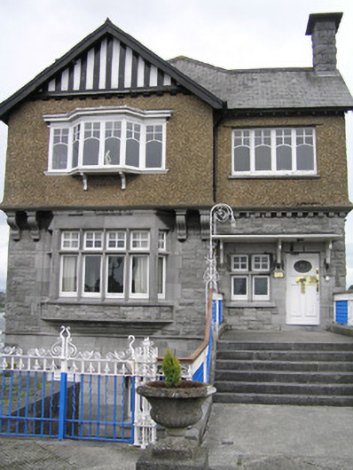 Shannon Rowing Clubclubhouse · 85 yd
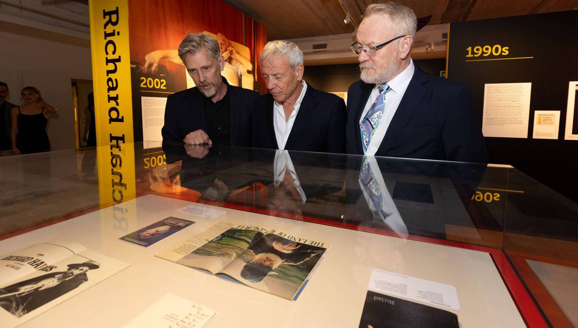 Richard Harris MemorialMonument · 316 yd
 CastleCastle, unclassified · 319 yd
 Docker's MonumentMemorial · 335 yd
 Six Gun BatteryMonument · 429 yd
 Curragower FallsWaterfall · 432 yd
 Castle Blake or Farranshone (Site of)Castle, unclassified · 437 yd
 Merchants QuayQuay · 493 yd
 King's IslandIsland · 978 yd
 Fountain SculptureHeritage attraction · 2.5 mi
Other information
Photo: Jamesanthonyohare · CC BY-SA 4.0