What is recorded here
Yes. The identity and request are clear. I will tell the story of the named place using the supplied facts, stay within the size limit, and return the finished paragraph without commentary.
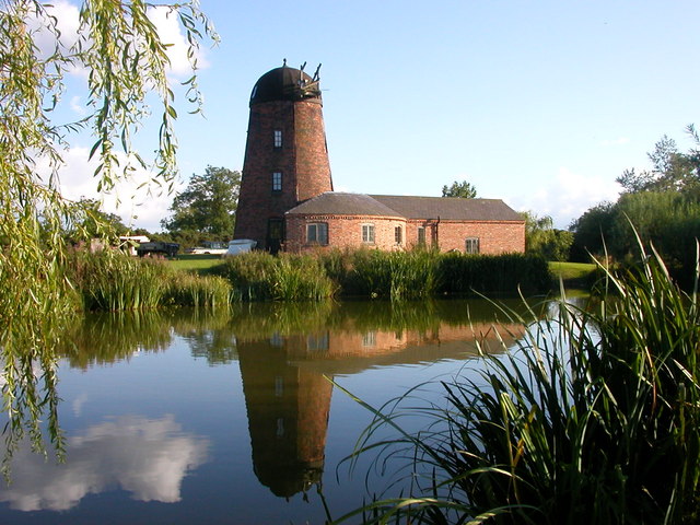
Small milling complex in sheltered valley near Roury river. Two-storey gable-ended corn mill; 2-storey storehouse added to SW. Infilled wheel-pit along NW gable. Wooden axle (L 1.5m; diam. 0.45m) with six arm sockets at each terminal in adjacent field. Mill contains mid-20th-century milling machinery. According to owner, the single storey additon along NE elevation of corn mill was used as a carding mill. Single-bay single-storey structure attached to residential house to SW was, according to owner, a tuck mill powered in 19th century by an 8ft waterwheel.
The above description is derived from the published 'Archaeological Inventory of County Cork. Volume 1: West Cork' (Dublin: Stationery Office, 1992). In certain instances the entries have been revised and updated in the light of recent research.
Date of upload/revision: 14 January 2009
The monument record does not grant public access. Check the route and ask the landowner before entering private land.
- What survives
- Recorded monument
Places near here
 Roury Bridgebridge · 43 yd
 Bridge in RouryglenBridge · 45 yd
 IndicatedFairy fort / stone ringfort · 954 yd
 Stone CircleStone circle, multiple-stone · 1.1 mi
 Drombeg Stone CircleArchaeological place · 1.1 mi
 Drombeg Fulacht Fia and RuinsVisitor information · 1.2 mi
 Trá an tAonaighBeach / strand · 1.2 mi
 Lookout over MillcoveViewpoint · 1.2 mi
 Castle SalemCastle · 1.4 mi
 Walk 1 - Drombeg Standing Stone Circle (7 - 9 km)Walking route · 1.5 mi
 The Black RocksIslet · 2.0 mi
 Prison CoveBeach / strand · 2.2 mi
Other information
Photo: Credit not shown in the picture search · Rights wording not checked; contact us if this picture should be removed