What is recorded here
Downhill holds the broken bones of a megalithic tomb built before written history. Huge stones once rose there, perhaps marking a grave or a boundary for people whose names vanished. Only remnants survive now, buried under grass and time. The completeness is gone, but the scale remains visible enough to remind us that Downhill was inhabited long before modern borders or roads.
The official Northern Ireland record identifies this as Remains of a megalithic tomb. Recorded period: PREHISTORIC. The official map point was placed at the centre of the recorded archaeological site from the source map reference.
Megalithic tomb, dating to the Neolithic period. Its significance lies in its contribution to understanding early prehistoric funerary practices and monument construction in Northern Ireland.
The monument record does not grant public access. Check the route and ask the landowner before entering private land.
- What survives
- Recorded monument
Places near here
 Enclosure in DownhillEnclosure · 453 yd
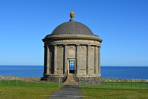 Mussenden TempleHeritage attraction · 544 yd
 Christ ChurchChurch · 713 yd
 Earl Bishop's Tree Trail, DownhillWalking route · 841 yd
 MausoleumMonument · 956 yd
 Downhill DemesneVisitor information · 983 yd
 CHURCH & GRAVEYARD in DownhillCHURCH & GRAVEYARD · 1140 yd
 Downhill BeachVisitor information · 1219 yd
 Castlerock BeachBeach / strand · 1427 yd
 St. Mary's RC ChurchChurch · 1.2 mi
 Portstewart StrandBeach / strand · 2.2 mi
 Ballyhacket ViewPicnic place · 2.8 mi