What is recorded here
Scout Bush, Scout Guard or Lettice Land: a fort in County Antrim, recorded from the late medieval period onward. Stone, grass and memory have worn its edges smooth, yet the names still circle like guards on a night watch. Perhaps people walked there to watch the sea, keep firewood hidden or simply belong somewhere unusual. The land remembers being shaped; human hands may have done the shaping.
The official Northern Ireland record identifies this as ARTILLERY FORT: SCOUT BUSH or SCOUT GUARD or LETTICE LAND. Recorded period: LATE-MED; POST-MED. The official map point was placed at the centre of the recorded archaeological site from the source map reference.
The monument record does not grant public access. Check the route and ask the landowner before entering private land.
- What survives
- Recorded monument
Places near here
 O'Haughan's CaveCave · 1.1 mi
 Knockagh MonumentMonument · 1.1 mi
_-_geograph.org.uk_-_652849.jpg?width=1280) The County Antrim War MemorialMemorial · 1.1 mi
The County Antrim War MemorialMemorial · 1.1 mi TOWER-HOUSE: CASTLE LUG or CLOGH-NA-LARTY in West DivisionTOWER-HOUSE: CASTLE LUG or CLOGH-NA-LARTY · 1.4 mi
 ENCLOSUREENCLOSURE, TREE RING?: PROSPECT HOUSE · 1.5 mi
_-_geograph.org.uk_-_3549028.jpg?width=1280) Kelly's Coal OfficeOffice · 1.8 mi
Kelly's Coal OfficeOffice · 1.8 mi MEDIEVAL PARISH CHURCH, POST-MED. & MODERN CHURCH & GRAVEYARD: ST NICHOLAS' CHURCH, ST NICHOLAS OF CRAGFERGUS in CarrickfergusMEDIEVAL PARISH CHURCH, POST-MED. & MODERN CHURCH & GRAVEYARD: ST NICHOLAS' CHURCH, ST NICHOLAS OF CRAGFERGUS · 1.9 mi
 Siege of Carrickfergussiege · 1.9 mi
 Battle of Carrickfergus (1760)Major battlefield · 1.9 mi
 Carrickfergus CastleCastle · 1.9 mi
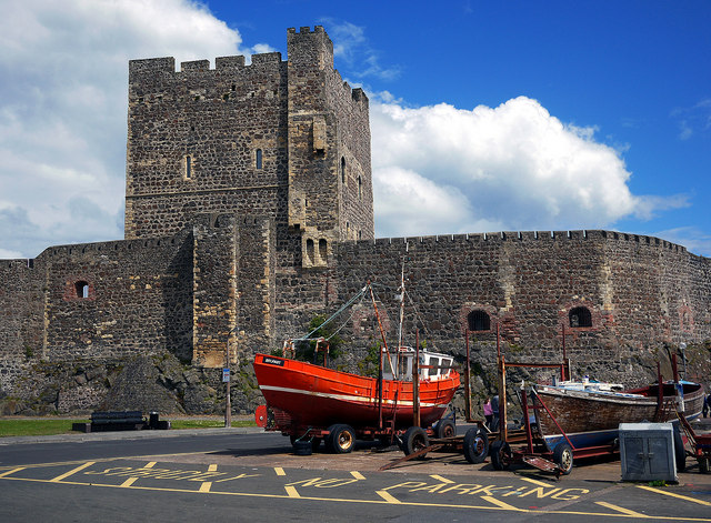 CARRICKFERGUS CASTLE in CarrickfergusCARRICKFERGUS CASTLE · 1.9 mi
 Carrickfergus MuseumMuseum · 2.0 mi