
What is recorded here
Thirty metres of limestone, fifteen of shadow, a room built without doors in the Burren pasture. O Rahilly called it circular, the sky photograph square; both were right because the hill itself is contradictory. Seven years of grass swallowed the edges, yet the chamber remains visible from above, waiting for someone to stop measuring and sit inside.
In rough pasture on limestone pavement within a large multiperiod field system (CL008-109001-). Indicated on Robinson's (1977) map of the Burren. Visible on OSi aerial imagery dated 2005 as a small roughly square enclosure (c. 16m WNW-ESE; c. 15m NNE-SSW). Described by O Rahilly (pers. comm. 1995) as ‘a circular platform enclosure’. More recent aerial imagery (MapGenie 2013-2018) indicates that it is heavily overgrown. There is a court tomb (CL008-002001-) c. 75m to the W.
Compiled by: Olive Alcock and Conn Herriott
Date of upload: 17 August 2022
The monument record does not grant public access. Check the route and ask the landowner before entering private land.
- What survives
- Recorded monument
Places near here
 Court tomb in TeergoneanCourt tomb · 93 yd
 Enclosure in KillilaghEnclosure · 170 yd
 CastleCastle, unclassified · 1556 yd
 Catholic Church of the Holy Rosarychurch/chapel · 1580 yd
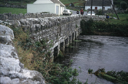 bridgebridge · 1693 yd
 Doonmacfelim Castle (in Ruins)Castle, tower house · 1745 yd
 Aran View SwalletCave · 1746 yd
 Fisherstreet PotCave · 1.1 mi
 Doolin PointHeadland · 1.1 mi
 Doolin FerriesHeritage attraction · 1.2 mi
 Wild Atlantic Way: Doolin PierVisitor information · 1.2 mi
 Ballaghaline PointHeadland · 1.3 mi
Other information
Photo: Credit not shown in the picture search · Rights wording not checked; contact us if this picture should be removed