What is recorded here
Within a cashel (CL009-001003-). This Man-made underground passage is defined by a circular depression in the S centre of the interior, possibly a collapsed chamber, which opens into an underground passage (L 6.7m; Wth 1.6m; max. H 1.27m) extending NNW; as it does so it becomes narrower (min. Wth 1.1m). The base of the side-walls of the passage incorporate natural limestone bedrock, while the upper part is constructed of uncoursed drystone-walling. It is roofed with large limestone slabs. On the ground surface, to the E of the N end of the passage, a smaller circular depression in which drystone-walling is visible may be the remains of a second chamber. To the S of the passage, an area covered with undulating grassed-covered rubble and limestone uprights may be part of a further collapsed section, which would give it an overall length of 11.1m.
Compiled by: Olive Alcock and Conn Herriott
Date of upload: 16 August 2022
The monument record does not grant public access. Check the route and ask the landowner before entering private land.
- What survives
- Recorded monument
Places near here
 Enclosure in TeergoneanEnclosure · 205 yd
 Court tomb in TeergoneanCourt tomb · 209 yd
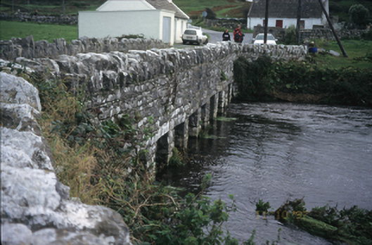 bridgebridge · 1547 yd
 Doonmacfelim Castle (in Ruins)Castle, tower house · 1564 yd
 CastleCastle, unclassified · 1570 yd
 Catholic Church of the Holy Rosarychurch/chapel · 1606 yd
 Fisherstreet PotCave · 1703 yd
 Doolin PointHeadland · 1.0 mi
 Aran View SwalletCave · 1.0 mi
 Doolin FerriesHeritage attraction · 1.1 mi
 Wild Atlantic Way: Doolin PierVisitor information · 1.1 mi
 Ballaghaline PointHeadland · 1.2 mi