What is recorded here
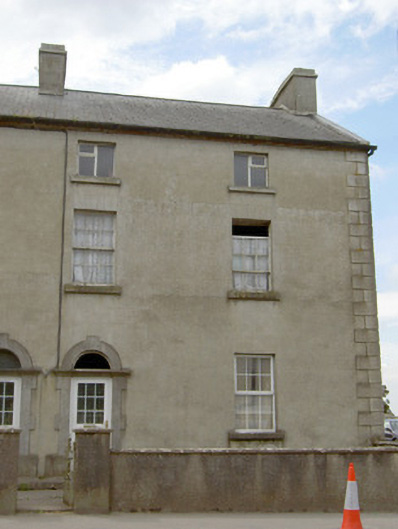
Semi-detached two-bay three-storey with attic storey house, built c. 1815, one of a pair with the building adjacent to the southeast (13310004). Pitched slate roof with limestone coping to gable end, two rendered chimneystacks and cast-iron rainwater goods. Lined-and-ruled rendered walls, roughcast to northwest gable elevation, with render quoins to the corner. Square-headed window openings with limestone sills, replacement timber windows to second floor, six-over-six pane timber sliding sash windows to first floor and replacement window to ground floor. Round-headed door opening with replacement door, fanlight and having dressed limestone block-and-start surround with carved limestone cornice to lintel. Slightly set back from the street with rendered boundary walls to road-frontage. Shared pedestrian gateway having rendered piers and iron gate. Located to the northwest end of Lanesborough.
This house, of late-Georgian appearance, retains its early form, character and much of its early fabric despite some alterations to the ground floor openings. Its tall form makes it an imposing and important feature on the streetscape. It retains interesting features such as the timber sliding sash windows and its façade is enlivened by the well-crafted cut stone doorcase and cornice, which is of artistic merit. It forms an interesting pair with its neighbour to the southeast (13310004) and represents an integral element of the built heritage of Lanesborough. Sensitively restored, this building would have a significant contribution to the historic character of the town. Either this building or its neighbour was in use as a post office in 1914 (Ordnance Survey third edition six-inch map).
This does not grant access. Most recorded buildings are privately owned; view them only from public ground unless the owner allows entry.
Places near here
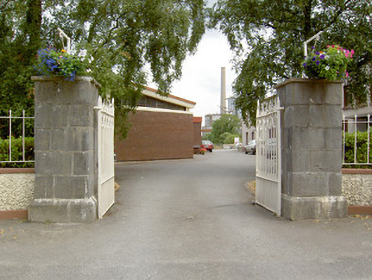 gates/railings/wallsgates/railings/walls · 32 yd
 Bridge in LanesboroughBridge · 106 yd
 Commons North WalkVisitor information · 368 yd
 Wild birdsVisitor information · 910 yd
 Ballyclare IslandIslet · 1557 yd
 White Sand WoodWood · 1.1 mi
 Rathcline CastleBawn · 1.5 mi
 Cross in Glebe (rathcline By., Rathcline Ed)Cross · 2.1 mi
 IndicatedFairy fort / earthen ringfort · 2.1 mi
 FerrinchIslet · 3.0 mi
 Slieve BawnMountain / peak · 4.5 mi
 Doughill ForestForest · 4.9 mi
Other information
Photo: National Inventory of Architectural Heritage · Website use allowed for educational or private purposes with source credit