What is recorded here
Knockacarrigeen holds a faded oval rath, forty-eight metres long, where field walls now cut through the ancient earth. The surviving bank and shallow ditch mark a boundary that human hands have repeatedly crossed, reduced, or forgotten. What lived inside may have been a home, a shrine, or a story told to children about fairy forts. The land keeps the shape even when the meaning blunts.
In undulating grassland. Very poorly preserved oval rath (E-W c. 48m, N-S c. 39m) defined by a denuded bank from S through W to N. Elsewhere a degraded scarp forms the enclosing element. A shallow external fosse survives from S to W. Field walls cut the monument at E, S and W.
The above description is derived from the published 'Archaeological Inventory of County Galway Vol. II - North Galway'. Compiled by Olive Alcock, Kathy de hÓra and Paul Gosling (Dublin: Stationery Office, 1999).
Date of upload: 05 August 2010
The monument record does not grant public access. Check the route and ask the landowner before entering private land.
- What survives
- Recorded monument
Places near here
 LisheenArchaeological place · 947 yd
 Hillfort in Carrowntemple (clare By.),knockacarrigeen,pollaturk OR NewgardenHillfort · 1182 yd
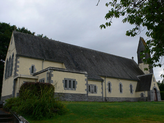 Catholic Church of the Sacred Heartchurch/chapel · 1256 yd
 Church (in Ruins)Church · 1399 yd
 CastleCastle, motte · 1452 yd
 Cashlaun Feecul in ruinsCastle, unclassified · 1.5 mi
 KnockmaaWood · 1.8 mi
 Mass RockNamed rock · 2.8 mi
 European ashEuropean ash · 3.8 mi
 Kilcoona Round TowerHeritage attraction · 5.5 mi
 Walsh's IslandIslet · 9.2 mi
 Oileán an AoilIsland · 9.8 mi