What is recorded here
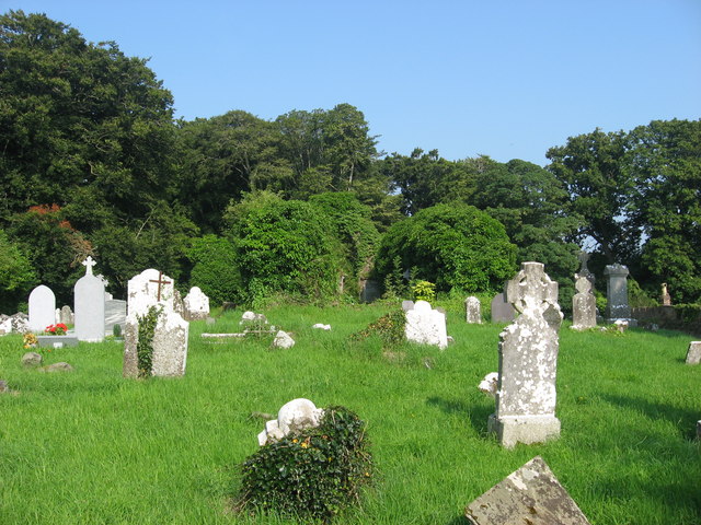
Grave Yard stands at the southern edge of a small plateau in County Meath, overlooking the River Nanny valley. The rectangular enclosure measures seventy by forty metres and surrounds the parish church of Kilsharvan. Masonry walls rise two metres on four sides, though brick courses have heightened three of them. The northern boundary remains open where an old road passes, linking the dead to the living traffic of Julianstown and Duleek.
Situated at the S edge of a small plateau with the valley of the W-E River Nanny immediately to the S and the stream is c. 90m to the S. The parish church of Kilsharvan (ME027-009----) is in a rectangular graveyard (dims c. 70m E-W; c. 40m N-S) defined by masonry walls (H c. 2m) on four sides. The walls have been heightened with brick courses (H c. 1m) at E, S, and W, but not at N where there is an E-W section of the old Julianstown to Duleek road.
Compiled by: Michael Moore
Date of upload: 22 December, 2014
The monument record does not grant public access. Check the route and ask the landowner before entering private land.
- What survives
- Recorded monument
Places near here
 Church (in Ruins)Church · 8 yd
 Enclosure in Newhaggard (duleek Upper)Enclosure · 248 yd
 Beaumont Br.Bridge · 637 yd
 CrossCross, Wayside cross · 970 yd
 CastleCastle, unclassified · 1.4 mi
 Platin HouseCastle, unclassified · 2.2 mi
 Newgrange Business ParkMemorial · 2.8 mi
 Battle of Julianstownbattle · 2.9 mi
 Common LimeCommon Lime · 2.9 mi
 Glenmore ForestWood · 4.0 mi
 Yellow IslandIslet · 4.2 mi
 Brú na Bóinne Visitor Centre AccessHeritage attraction · 4.4 mi