
What is recorded here
Slightly S of and below the crest of an E-W ridge of hills running along the N side of the Nuenna river valley, in rough pasture and bracken. There are good views in all directions, except to N. Identified as an enclosure on an aerial photograph (GSI S421, 1:30,000). A roughly oval enclosure (dims. 51m NE-SW; 44m NW-SE) defined by an earthen bank (int. H 0.5m; ext. H 0.5m; Wth at crest 1.5m; overall Wth 3m), except in the N quadrant where the enclosure is built into the hillslope creating a drop (H 1m) from the external ground level to the interior. Much of the interior has been quarried into and there is also a small quarry pit (dims. c. 10m) in the N quadrant through the enclosing element. A trackway which runs up to the NE angle of the enclosure appears to run E-NE towards the farm buildings at Killoshulan Castle (KK09-056001-) c. 500m to the ENE or towards the road to the NE. As with the enclosure, the quarry and trackway are not indicated on any OS maps, however, both the latter are possibly contemporary. There are openings through the bank in the SE and SW with a trackway running up to both, probably a farm trackway. A number of field boundaries radiate from the enclosure.
Compiled by: Jean Farrelly
Date of upload: 1 April 2020
The monument record does not grant public access. Check the route and ask the landowner before entering private land.
- What survives
- Recorded monument
Places near here
 Killoshulan Castle (ruin)Castle · 545 yd
 TempleclashshibaunChurch · 598 yd
 Clomantagh Lower RingfortArchaeological place · 866 yd
 IndicatedEnclosure · 1343 yd
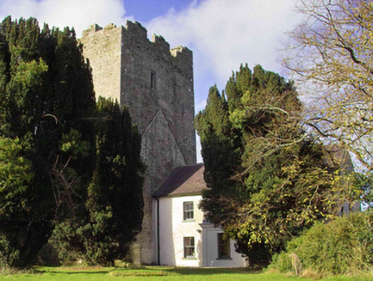 farm housefarm house · 1434 yd
 CastleCastle, tower house · 1442 yd
 Clomantagh HillMountain / peak · 1.5 mi
 Kildrinagh WoodForest · 3.0 mi
 John HelyMemorial · 3.4 mi
 DelaneyMemorial · 3.5 mi
 Street fieldArchaeological place · 4.0 mi
 Anker's IslandIsland · 7.3 mi
Other information
Photo: Credit not shown in the picture search · Rights wording not checked; contact us if this picture should be removed