What is recorded here
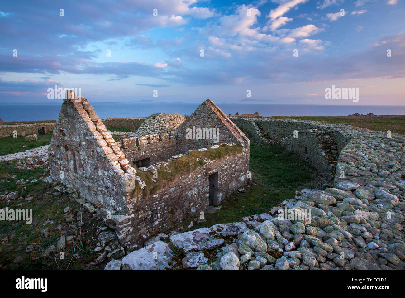
Inishmurray’s men’s cemetery holds two hundred graves beside Templemolaise, where carved crosses and plain sandstone slabs still stand in rows. The stones cluster around Teach Molaise, suggesting the founder’s shrine drew the island’s dead toward a single holy address. Even the forgotten men beneath the turf may have chosen that place because they believed Molaise himself still lived inside the small church wall.
In an ecclesiastical enclosure (SL001-001001-) known as ‘the Cashel’. The graveyard extends across the central and eastern part of the cashel, and is bounded to N, W and S by walls which form internal subdivisions within the Cashel. It is traditionally known as ‘the Men’s Cemetery’.
Grave markers occur throughout the open area surrounding Templemolaise (SL001-001009-). There are 180–200 visible grave markers (it is impossible to say how many of the smaller prone slabs were originally erected as headstones). These take various forms, including several early carved slabs and pillars (with crosses or memorial inscriptions), cist-like arrangements of edge-set slabs or ceallunach graves, modern plinthed crosses with memorial inscriptions and, most commonly, low, rough, unmarked sandstone headstones set upright in the turf. Most of these grave markers occur in the open area between Templemolaise (SL001-001009-) and the much smaller church known as Teach Molaise (SL001-001005-). The importance of the latter – the purported founder’s tomb shrine – is indicated by the concentration of early inscribed stones and cross slabs lying immediately adjacent to it. Other notable, though smaller concentrations occur by the south wall of Templemolaise and around the Clocha Breaca leacht (SL001-001013-). Both the early slabs by Teach Molaise and the many plain, low headstones form rows on a north/south alignment (indicating west/east grave orientation). Thus, in broad terms, the orientation and limits of the cemetery accord with the north/south boundary formed by the western enclosure [subdivision] and the east/west boundary formed by the northern enclosure [subdivision]. In contrast, grave markers peter out towards the southern enclosure [subdivision]. Significantly, perhaps, this was probably reserved for burials of the Waters family (Mountbatten 1972, 50) and may be an entirely modern construction.
The above description is derived from the results of a survey of the archaeological monuments on Inishmurray undertaken in 1997-1999 and published in:
Jerry O’Sullivan and Tomás Ó Carragáin 2008 Inishmurrary. Monks and pilgrims in an Atlantic landscape. Volume 1: Archaeological Survey and Excavations 1997-2000. Cork. The Collins Press.
Date of upload: 16 January 2018
A medieval graveyard within an early Christian ecclesiastical enclosure; significance lies in its association with the historic monastery of Inishmurray, an important religious site in the Atlantic seaboard monastic tradition.
The monument record does not grant public access. Check the route and ask the landowner before entering private land.
- What survives
- Recorded monument
Places near here
 Teampull Molaise, TeampullnabarChurch · 5 yd
 St Molaises ChapelChurch · 19 yd
 Inishmurray Island Monastic SiteHeritage attraction · 56 yd
 Laghta ColumbkilleLeacht · 114 yd
 Enclosure in InishmurrayEnclosure · 134 yd
 InishmurrayIsland · 153 yd
 Streedagh BeachVisitor information · 4.3 mi
 de Cuellar Armada MonumentMemorial · 4.4 mi
 Connors IslandIsland · 5.4 mi
 Bawn in DoonforeBawn · 5.7 mi
 Knocklane CastleRuins · 5.8 mi
 Upperglen WoodForest · 6.1 mi