What is recorded here
At the NE end of a narrow strip of deciduous woodland, surrounded by level pasture, on former demesne grounds. A roughly circular area (diam 35m) is defined by a very substantial drystone wall, built in straight sections of large inner and outer stones facing a rubble core (T 1.9-2.4m; int. H 1-1.6m; ext. H 1.3m at E-2.1m at N). The N-half of the interior contains a 17th-century church (GA114-063----) with a later extension and a late 19th-century Bingham family mausoleum. A wide piered entrance was created in the cashel wall at SE to allow access to these structures, and the cashel wall was narrowed (Wth 1.3m) at WNW to accommodate the construction of the mausoleum.
Compiled by: Gearóid Conroy
Date of upload: 08 August 2012
The monument record does not grant public access. Check the route and ask the landowner before entering private land.
- What survives
- Recorded monument
Places near here
 R.C. Chapel (in Ruins)Church · 11 yd
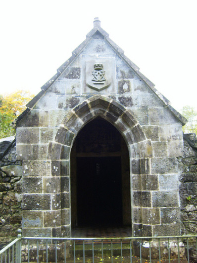 mausoleummausoleum · 16 yd
 CaveMan-made underground passage · 678 yd
 IndicatedEnclosure · 737 yd
 Castle (in ruins)Castle, Anglo-Norman masonry castle · 1199 yd
 Ballymaquiff CastleCastle · 1.9 mi
 Drumharsna CastleHeritage attraction · 2.3 mi
 HawthornHawthorn · 2.8 mi
 European ashEuropean ash · 2.8 mi
 Drumacoo Monastic SiteHeritage attraction · 5.6 mi
 Mulroney's IslandIslet · 6.4 mi
 Kilmacduagh Monastic SiteVisitor information · 8.3 mi