
What is recorded here
In cutaway bog, in the Imlagh Basin. Prior to excavation this hut site was visible as a rectangular mound of stone which protruded above a thin layer of peat. Excavation, undertaken in 1994, revealed a trapezoidal hut site (3.4m N-S x 1.6-2.8m E-W) defined by a drystone wall (T 1.5-2m; H 1m) which was slab lined internally in places. There was a stone-lined entrance passage (L 2.6m NW-SE; Wth 1.2m) at the narrower S end of the hut site. According to the excavator (Hayden 1994b, 14), the position of a collapsed flat slab in this entrance area suggested that the passage may have originally been roofed with stone slabs. The passage and the area immediately outside the entrance to the SE were paved with closely set flat slabs. Two rectangular stone-walled annexes backed onto the hut site at the NW and S. The rectangular annexe (1.5m NW-SE; 1.4m NE-SW) at the NW was defined by the N wall of the main hut site along the S side and elsewhere by a drystone wall (T 0.8-1m; H 0.8m). This wall was also slab lined internally in places. The W jamb of an entrance (Wth 0.8m) in the NE corner was marked by a large pillar-like stone. A large rectangular stone that lay in the entrance was probably the original lintel over the entrance (Hayden 1994b, 16). The annexe had a roughly paved floor which had been damaged when the walls and roof collapsed onto it (ibid.). A stone spindle whorl and a number of water-worn stones were recovered from a layer above the paving. The roughly circular annexe (c. 3.4m N-S; c. 2.7m E-W) at the S was not excavated but a line of vertically set slabs along the inner wall-face was traceable. A large pillar-like stone may also have marked the W jamb of an entrance to this annexe. A small, stone-lined hearth was situated in the main hut site and deposits of ash occurred on the floor. A sample of this burnt material, containing small mammal and fish bones, yielded a calibrated date at 2 sigma confidence level of between 562 and 758AD (GrN21031). A number of blue glass beads, stone spindle whorls and rubbing stones were found within the occupation debris. (Hayden 1994b, 13-19; Hayden 1995b, 44)
The above description is derived from the published 'Archaeological Inventory of County Kerry. Volume I: South-West Kerry' (Dublin: Stationery Office, 2009). In certain instances the entries have been revised and updated in the light of recent research.
Date of upload: 30 May 2011
The monument record does not grant public access. Check the route and ask the landowner before entering private land.
- What survives
- Recorded monument
Places near here
 RoadRoad, road/trackway · 185 yd
 Field system in Bray,coarha Beg,coarha More,cool East,cool WestField system · 332 yd
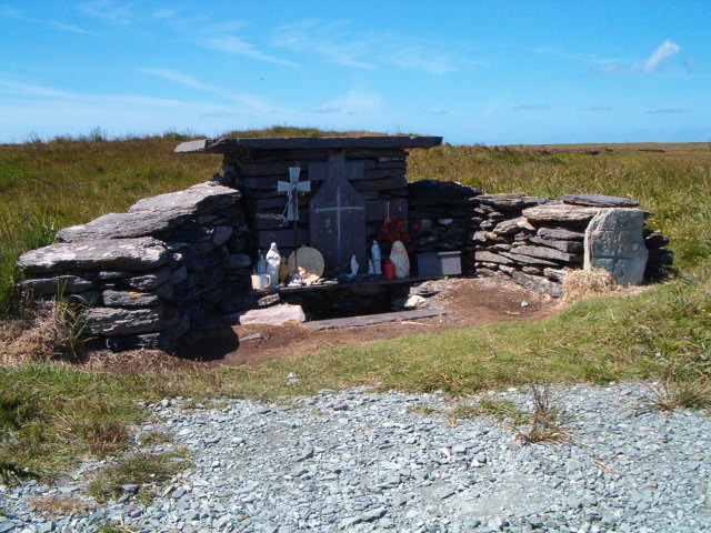 Tobar Olla BrenainnHoly well · 448 yd
 Culloo RockViewpoint · 1186 yd
 Telegraph Field Valentia IslandMemorial · 1.1 mi
 MillMill, unclassified · 1.3 mi
 Bray HeadMountain / peak · 1.4 mi
 Horse IslandIslet · 1.7 mi
 ValentiaIsland · 1.9 mi
 Skellig Experience CentreMuseum · 1.9 mi
 Fogher CliffCliff · 2.3 mi
 GeokaunMountain / peak · 2.6 mi
Other information
Photo: Credit not shown in the picture search · Rights wording not checked; contact us if this picture should be removed