What is recorded here
Indicated is a broken fairy fort in County Kerry, Ireland, where a farm track has cut through its north-east edge and cattle still disturb the remaining earth bank. The place has lost part of its shape to human use, but the circular memory remains visible in the slope, scarps and surviving bank. It is no longer a complete fortress, yet it still marks the ground as a place set apart.
In pasture adjacent to a farmyard, on a SE-facing slope. This rath is indicated as a roughly circular enclosure (diam. c. 50m) with trees around its perimeter on the 1846 OS 6-inch map. It is indicated as a circular enclosure (diam. c. 45m) on the 1939 OS 6-inch map. The interior is now defined by an earthen bank (Wth 7.6m; int. H 0.2m; ext. H 1.6m) NW-N and by a scarp E-NW. The NE sector is truncated by a NW-SE farm trackway and is occupied by farm buildings. The bank is disturbed by cattle and tree roots NW-N. The interior slopes down to the SE; the ground surface is uneven due to grassed-over dumped material. A modern brick-built shed is immediately inside the bank at N. A N-S field boundary extends from the bank along the S arc. Farm building occur outside the base of the scarp at SE. There is a Man-made underground passage (KE066-007001-) in the SE quadrant.
Compiled by: Elizabeth Byrne, Ursula Egan and Sheila Ronan, Archaeological Survey Unit, University College, Cork.
Date of upload: 31 January 2011
The monument record does not grant public access. Check the route and ask the landowner before entering private land.
- What survives
- Recorded monument
Places near here
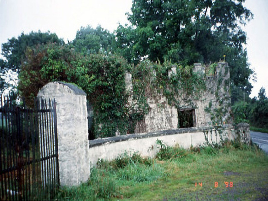 Grenagh Housegate lodge · 396 yd
 Grenagh Ho.Country house · 841 yd
 CastleCastle, tower house · 963 yd
 Castle (in Ruins)Castle, tower house · 1284 yd
 IndicatedFairy fort / earthen ringfort · 1312 yd
 European YewEuropean Yew · 1374 yd
 Japanese pagoda treeJapanese pagoda tree · 1382 yd
 Man-made underground passage in BeaufortMan-made underground passage · 1461 yd
 Dunloe Ogham StonesHeritage attraction · 1.0 mi
 Rabbit or Brown IslandIslet · 2.5 mi
 Aghadoe Early Medieval Ecclesiastical SiteHeritage attraction · 2.7 mi
 O'Sullivan's CascadeWaterfall · 2.8 mi