What is recorded here
Grallagh holds a curving southern ditch that may have enclosed the early monastery of St Maccallin before the graveyard expanded northward. The name An Ghreallach acknowledges the local mire, yet the church, well and stone still mark a place where people went to pray, remember and perhaps touch the holy stone. What is certain is the shape preserved in soil: a small circular boundary later absorbed into a larger rectangular ground.
Grallagh church (DU007-001001-), graveyard (DU007-001004-), holy well (DU007-001002-) and holy stone (DU007-001003-) may have been built on the site of an early Christian monastery (DU007-001006-) founded by St Maccallin. Situated on undulating pasture, with poorly drained land immediately to S and higher well drained land to N and E. St John's Well (DU007-002----) lies 60m to S. Grallagh (An Ghreallach/miry place) graveyard (DU007-001004-) appears to have been a smaller circular-shaped burial ground enclosed by a bank with external fosse that was extended to the N forming the present large sub-rectangular shaped graveyard (H. A. Wheeler Report 15/04/1975, SMR File). Traces of the original circular-shaped graveyard are visible in the graveyard as a curving shallow bank and ditch to W. The curving boundary of the ditch at S represents the original enclosing feature of the graveyard. It is possible that the curving boundary ditch represents the remains of an early Christian enclosure associated with a monastery (DU007-001006-) founded by St Maccallin/Maccullin. The curving S boundary of the graveyard marks the boundary with Cottrelstown townland.
Compiled by: Caimin O'Brien
Date of upload: 4 April 2023
The monument record does not grant public access. Check the route and ask the landowner before entering private land.
- What survives
- Recorded monument
Places near here
 graveyard/cemeterygraveyard/cemetery · 4 yd
 Church (in ruins)Church · 16 yd
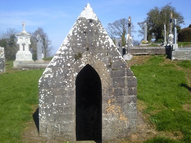 St. Michaels WellHoly well · 34 yd
 Ritual siteRitual site, holy/saint's stone · 41 yd
 St. John's WellSpring · 205 yd
 Cornstown HouseHeritage attraction · 2.4 mi
 St Kenny's WellSpring · 2.5 mi
 Naul HillMountain / peak · 2.6 mi
 Wooly Ward's FarmHeritage attraction · 2.8 mi
 Hollywood GreatMountain / peak · 3.0 mi
 Newtown GorseWood · 3.5 mi
 Bawn in KilleglandBawn · 3.9 mi