What is recorded here
Lisnacroba was a subcircular earthen ringfort on a grassy rise east of the Loughrea-Kilreekill road, measured at roughly forty metres across when first mapped in 1838. By 1947 the earthworks had partially levelled, and by 1984 no surface trace remained visible to the eye. Yet the outline still emerges in aerial photography, suggesting the ground remembers what human activity has erased. An underground passage lies nearby, hinting that the site may have served purposes beyond ordinary dwelling.
On a rise in undulating grassland and immediately to the E of Loughrea-Kilreekill road. Marked on the 1838 edition of the OS 6-inch map as a subcircular enclosure (c. 41m N-S; c. 39m E-W ); partially levelled by the time of the 1947 edition. On inspection in April 1984 no visible surface trace survived. However, its outline is visible on the OSi digitalglobe aerial photograph. A Man-made underground passage (GA098-106001-) is associated. A dwelling house has been built to the SW.
Compiled by: Galway Archaeological Survey, UCG
Date of upload: 8 March 2019
Lisnacroba, Glenmeen is a subcircular early-medieval ringfort, likely dating to between the 6th and 10th centuries AD, situated on a rise near the Loughrea-Kilreekill road. It appears on the 1838 OS 6-inch map but was partially levelled by the time of later surveys; no specific folklore is recorded for this site.
The monument record does not grant public access. Check the route and ask the landowner before entering private land.
- What survives
- Recorded monument
Places near here
 Old ChapelChurch · 875 yd
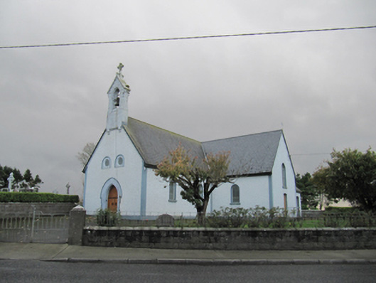 Catholic Church of Our Lady of Lourdeschurch/chapel · 890 yd
 Dartfield Horse MuseumHeritage attraction · 1496 yd
 TobermacduaghHoly well · 1709 yd
 Field system in BallynahistilField system · 1.1 mi
 Drought Castle (in Ruins)Castle, tower house · 1.1 mi
 Kilcooly Castle (in ruins)Castle, tower house · 1.8 mi
 Turoe StoneHeritage attraction · 4.8 mi
 Bush IslandIslet · 5.1 mi
 Middle IslandIslet · 5.1 mi
 Long PointHeadland · 5.1 mi
 Quarryhill WoodWood · 7.0 mi