What is recorded here
Gallaun was a standing stone outside a Cork ringfort, broken up before 1898 and erased from the land. Murphy recorded the loss with quiet anger, proving the stone existed even though nobody can point to it now. The ringfort remains, but its northern marker disappeared into road-building or forgetfulness. What is removed can still be known through the witness of someone who saw it stand.
Shown on 1842 OS 6-inch map just outside bank of ringfort (CO070-057001-), on N side. Removed. No visible surface trace. One of two stones (CO070-058----) referred to by Murphy (1898, 13) who noted it 'was broken up about twenty years ago'.
The above description is derived from the published 'Archaeological Inventory of County Cork. Volume 3: Mid Cork' (Dublin: Stationery Office, 1997). In certain instances the entries have been revised and updated in the light of recent research.
Date of upload/revision: 14 January 2009
Likely dating to the early medieval period, the stone may have had a ritual or commemorative function, possibly linked to the nearby ringfort. Its destruction in the 19th century has led to the loss of any potential inscriptions or carvings that might have clarified its original purpose.
The monument record does not grant public access. Check the route and ask the landowner before entering private land.
- What survives
- Recorded monument
Places near here
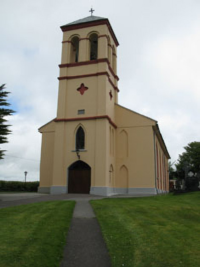 Séipéal Naomh Lachtáin [Saint Lachtáin's Catholic Church]church/chapel · 460 yd
 IndicatedHouse, indeterminate date · 1131 yd
 Burial ground in Baile An BhuaidhBurial ground · 1268 yd
 TobernabienHoly well · 1342 yd
 Port Ban Nature Reserve, Irish Wildlife TrustNature reserve · 2.0 mi
 Carrigaphooca CastleCastle · 2.5 mi
 Dundareirke Castle (in Ruins)Castle, tower house · 3.0 mi
 Curraheen WoodWood · 3.1 mi
 European long distance path E8 - part IrelandWalking route · 3.6 mi
 Cnoc na nUlán (mullach thoir)Mountain / peak · 4.6 mi
 KnockullaneMountain / peak · 4.8 mi
 Sli Gaeltacht MuscraiWalking route · 6.0 mi