
More pictures of this place


What is recorded here
It survived after people stopped using it as intended. The church, which played an important social function for the local Church of Ireland community, forms an important ecclesiastical group with the ruins of the older Clontibret church, graveyard and an early nineteenth-century schoolhouse to the south and a nearby former Glebe House to the east.
Freestanding gable-fronted Church of Ireland church, built 1840-2, comprising single-bay nave with gabled porch to gable-front, and vestry to south-east corner. Pitched natural slate roof, with dressed limestone copings, cast-iron rainwater goods, and twin octagonal-plan ashlar finials to apex of east gable. Rendered walls having dressed stone plinth, and with string course to gables at eaves level, and diagonal ashlar buttresses to nave corner. Pinnacled bell-cote containing bronze bell to gable-front. Ashlar walls to porch, having triangulated parapet. Chamfered dresssed limestone surrounds to all windows. Lancet windows to nave side walls and to gable-front and porch, with Y-tracery frames, double-light to nave side walls and Tudor-arch with four-light window to east gable, some windows having original stained glass, some replacement clear glass. Latticed window to front of porch, and blind openings to side walls, latter with hood-mouldings. Pointed-arch doorway to south side of porch, with double-leaf timber panelled door. Interior has Tudor-arch braced timber tie-beam trusses with decoratively-carved pendants. Smooth rendered walls, tongue-and-groove panelling to height of pews. Gallery to west end with organ, supported by quatrefoil-plan compound columns. Carved wooden pulpit to north-east corner, plain timber altar with pointed arcade to centre of east end, flanked by cast-iron communion rails. Pews to nave, baptismal font to west end and memorial plaques to walls of nave. Set in graveyard with coursed rubble boundary wall, having limestone coping and wrought-iron gate to main entrance at west. Ruin of sixteenth/early seventeenth-century church to south, and late eighteenth-century school-house to south at crossroads.
The church, which played an important social function for the local Church of Ireland community, forms an important ecclesiastical group with the ruins of the older Clontibret church, graveyard and an early nineteenth-century schoolhouse to the south and a nearby former Glebe House to the east.
Saint Coleman's Church, built in 1840, was, interestingly, built directly beside the ruins of a church, of the sixteenth or seventeenth century. Clontibret Church is shown on the first edition Ordnance Survey map of c.1835, and Lewis recorded in 1837 that the plain old church was in a very dilapidated condition. On the second edition Ordnance Survey published c.1908, the old church is shown in ruins and the new Saint Coleman's Church shown directly to the north-east. The church, which played an important social function for the local Church of Ireland community, forms an important ecclesiastical group with the ruins of the older Clontibret church, graveyard and an early nineteenth-century schoolhouse to the south and a nearby former Glebe House to the east. The mid-nineteenth-century church is of architectural as well as artistic significance with attractive stained glass. The interior holds further interest, with its unusual roof structure and its decorative pendants.
The story behind this place
The church, which played an important social function for the local Church of Ireland community, forms an important ecclesiastical group with the ruins of the older Clontibret church, graveyard and an early nineteenth-century schoolhouse to the south and a nearby former Glebe House to the east.
This does not grant access. Most recorded buildings are privately owned; view them only from public ground unless the owner allows entry.
Places near here
 IndicatedGraveyard · 18 yd
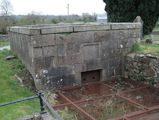 Saint Colman's Church (Clontibret)mausoleum · 30 yd
 Saint Colman's Church Hallschool · 57 yd
 Battle of ClontibretBattlefield · 1008 yd
 frotFairy fort / earthen ringfort · 1149 yd
 Castleshane WaterfallWaterfall · 2.5 mi
 Monaghan WayWalking route · 4.5 mi
 Caldwells' WoodWood · 5.2 mi
 Fort HillWood · 5.5 mi
 LisnaspeenanMountain / peak · 10 mi
 Fedd HillMountain / peak · 11 mi
 POST-MED CHURCH; GRAVEYARD: BALLYMOYER OLD CHURCH or LISDROMAUDE in BallintemplePOST-MED CHURCH; GRAVEYARD: BALLYMOYER OLD CHURCH or LISDROMAUDE · 13 mi
Other information
Photo: Deadstar · CC BY-SA 4.0