What is recorded here
Fairy fort in Rathanlon is a circular stone ringfort about thirty-seven metres across on a gentle rise in County Galway. It has no visible wall left, only faint traces and a rain-water collector inside the grass. The shape still belongs to human hands even though the stones disappeared.
On a gentle rise in rough grazing land. Classified by McCaffrey (1952, 285, no. 50a) as a circular ‘Stone fort’ (diam. c. 37.25m) defined by a double-faced drystone wall. Traces of an internal division or remains of possible hut sites were noted in the interior (SMR file). Apart from slight traces of a bank at W, no visible surface trace survives. A unit for collecting rain water occupies the interior.
Compiled by: Galway Archaeological Survey, UCG
Date of upload: 7 March 2018
The monument record does not grant public access. Check the route and ask the landowner before entering private land.
- What survives
- Recorded monument
Places near here
 IndicatedFairy fort / stone ringfort · 369 yd
 Enclosure in TulliraEnclosure · 412 yd
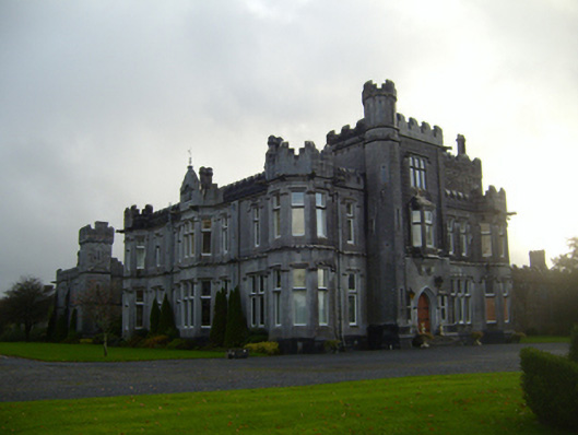 Tullira Castlecountry house · 1037 yd
 Loughnane and Quinn Memorial Halldemesne walls/gates/railings · 1153 yd
 Castle (in ruins)Castle, Anglo-Norman masonry castle · 1.2 mi
 Rahaly Castle (in ruins)Castle, tower house · 1.5 mi
 HawthornHawthorn · 2.1 mi
 European ashEuropean ash · 2.1 mi
 Drumharsna CastleHeritage attraction · 2.1 mi
 Drumacoo Monastic SiteHeritage attraction · 6.0 mi
 Mulroney's IslandIslet · 6.5 mi
 Kilmacduagh Monastic SiteVisitor information · 7.7 mi