What is recorded here
Lislaughtin is an earthen ringfort, a small fort built with soil and stone where people lived, worked and perhaps kept what they valued. The field has changed or been taken in since, which is common for small Kerry forts. What remains is the shape of human life in the land: a boundary, a household, a local world made visible before it disappeared under grass, plough or forgetting.
Lisrory/Lios Ruairí (ringfort of Ruairí - personal name Rory). Appears on the 1841-42 OS map as a univallate rath and on the later edition as a semicircular enclosure with the Glashanagalloon stream running through the site into Ballylongford Creek. No surface trace of this site could be found today.
The above description is derived from C. Toal, ‘North Kerry Archaeological Survey’. Dingle. Brandon in association with FAS Training and Employment Authority (1995), no. 190. In certain instances the entries have been revised and updated in the light of recent research.
Date of upload: 2 August 2013
The monument record does not grant public access. Check the route and ask the landowner before entering private land.
- What survives
- Recorded monument
Places near here
 Lislaughtin Abbey (in ruins)Religious house, Franciscan friars · 141 yd
 Ecclesiastical site in LislaughtinEcclesiastical site · 148 yd
 LislaughtinArchaeological place · 865 yd
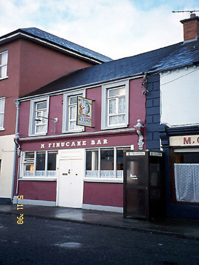 M. Finucanehouse · 1302 yd
 Siege of Carrigafoyle Castlesiege · 1.3 mi
 Carrigafoyle CastleCastle · 1.3 mi
 Carrigafoyle Cas. (in ruins)Castle, tower house · 1.3 mi
 Carrig IslandIsland · 1.6 mi
 Ballymacrinan BayBay · 3.9 mi
 Fawley's PointHeadland · 4.1 mi
 Scattery IslandIsland · 4.2 mi
 Scattery Island Visitor CentreVisitor information · 4.4 mi