What is recorded here
This monument straddles the top of a narrow WNW-ESE ridge in undulating pasture. Raised circular area (dims. 12.5m NNE-SSW; 9.7m WNW-ESE) enclosed from NE-S-NNW by a bank of earth and stone (Wth. 3m - 4m; H 0.5m - 1m) and elsewhere defined by a steep scarp. At the foot of the bank at E and W, where it cuts across the spine of the ridge, is a wide, deep fosse (Wth. 5m; D 1m) with ephemeral traces of a possible counterscarp bank. At the foot of the bank at S is a terrace (Wth. 3m). Fosse and terrace are absent at N. At SSE is a break in the bank (Wth. 1.6m) but there is no accompanying causeway. The internal ground level is uneven.
Compiled by: Patrick F. O'Donovan
Date of upload: 19 January 2011
The monument record does not grant public access. Check the route and ask the landowner before entering private land.
- What survives
- Recorded monument
Places near here
 Enclosure in ArdabroneEnclosure · 1245 yd
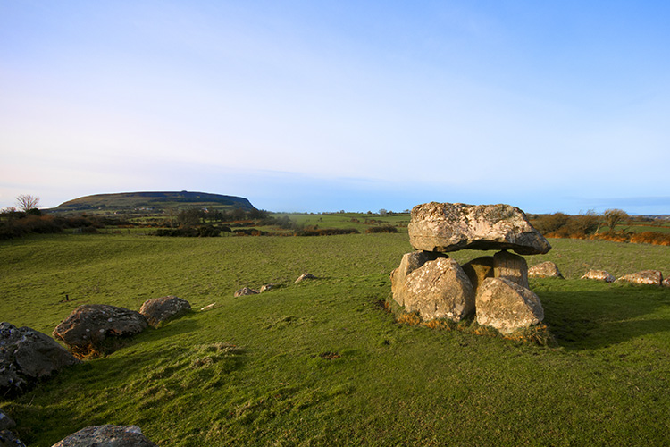 Megalithic structure in CarrowgilhoolyMegalithic structure · 1255 yd
 Saint Adamnan's Catholic Churchchurch/chapel · 1.1 mi
 Bawn in CarrowbrickeenBawn · 1.3 mi
 BawnmoyleRuins · 1.3 mi
 Giant's GraveArchaeological place · 1.4 mi
 CastleCastle, ringwork · 1.5 mi
 Lahanacappul IslandIslet · 2.0 mi
 Valley WoodForest · 2.0 mi
 Portavaud PointHeadland · 2.1 mi
 Ballinlig PointHeadland · 2.1 mi
 Pigeonpark WoodForest · 2.2 mi