What is recorded here
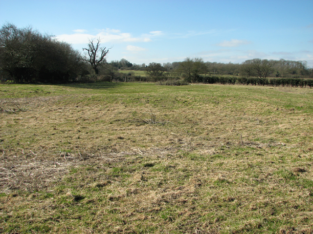
Half-hidden in scrub on a gentle slope in Dromeliagh, the fairy fort keeps its shape through a thin earthen bank, narrow ditch and faint outer ridge. Its eastern gap remains visible, while drainage has bitten into the southwestern ditch. The site may have been a dwelling, a boundary marker or a place people avoided after dark, but its exact purpose has faded like the outer bank itself.
Situated on a gentle SSW-facing slope in undulating pasture. The monument is masked by dense scrub vegetation. It is evident as a sub-oval area enclosed by an earthen bank (int. H 0.1m; Wth 2.3m; ext. H 0.8m), a fosse (Wth 2.7m) and an external bank (int. H 0.5m; Wth 2.7m; ext. H 0.2m). There is a gap in the enclosing element at E (Wth 1m). At SW drainage work has encroached on the fosse. The external bank is only faintly evident from SE to WSW, and more evident from SW to N.
Compiled by: Denis Power
Date of upload: 14 June 2013
The monument record does not grant public access. Check the route and ask the landowner before entering private land.
- What survives
- Recorded monument
Places near here
 Elm Grovehouse · 265 yd
 Bridge in AbingtonBridge · 686 yd
 IndicatedWeir, fish · 729 yd
 CastleCastle, unclassified · 880 yd
 Graveyard in AbingtonGraveyard · 882 yd
 Settlement desertedSettlement deserted, medieval · 1023 yd
 Bawn in RathBawn · 1.2 mi
 Sliev Felim WayVisitor information · 2.0 mi
 Slieve Felim WayWalking route · 4.9 mi
 KnockseefinMountain / peak · 5.5 mi
 ToberagaddySpring · 6.2 mi
 St. Patrick's WellSpring · 7.2 mi