What is recorded here
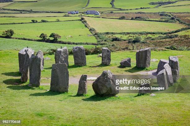
Drombeg holds three stone circles, but this forgotten earthen ring sits beside them, a shallow bowl of packed earth and scattered stone on a NE-facing slope. It is small enough to walk across in breath, yet the bank still rises a metre above the grass and a narrow ditch cuts the western edge. Perhaps it was a dwelling, a boundary marker, or a child circle drawn by hands that never learned to build tall. The land kept the shape long after the names disappeared, proving that size does not decide whether a place remembers.
In pasture, on NE-facing slope. Circular area (21m N-S; 22m E-W) enclosed by low earthen bank (int. H 1.1m), stone faced in parts to W; external fosse to W (D 0.6m). Field boundary atop bank at S. Gap in bank to ENE.
The above description is derived from the published 'Archaeological Inventory of County Cork. Volume 1: West Cork' (Dublin: Stationery Office, 1992). In certain instances the entries have been revised and updated in the light of recent research.
Date of upload/revision: 14 January 2009
The monument record does not grant public access. Check the route and ask the landowner before entering private land.
- What survives
- Recorded monument
Places near here
 Fulacht fia in Drombeg (ibane and Barryroe By.)Fulacht fia · 150 yd
 Mass-rock in Drombeg (ibane and Barryroe By.)Mass-rock · 415 yd
 road (section of)road (section of) · 1212 yd
 Muckruss HouseCountry house · 1442 yd
 Inchydoney BeachBeach / strand · 1.0 mi
 CastleCastle, unclassified · 1.2 mi
 Clonakilty HarbourBay · 1.6 mi
 Clonakilty Blackpudding Visitor CentreHeritage attraction · 1.8 mi
 Cloch na gCoillteMemorial · 1.9 mi
 Coast ViewViewpoint · 1.9 mi
 Stoney Beach RingBeach / strand · 2.0 mi
 Clonakilty Tourist OfficeVisitor information · 2.0 mi