
What is recorded here
Indicated is a fairy fort on a Monaghan drumlin, a broad earthen ring with a broken causeway pointing east like a finger pressing through grass. People may have lived inside its bank before forgetting the name, or the fairies may have taken the house and kept the shape. Either way the ridge still holds the outline of a door, waiting for someone bold enough to walk through.
Located at the crest of the S-facing slope of a short N-S drumlin ridge. This is a circular grass and rush-covered area (diam. 40.5m) that slopes down to the S and is defined by an overgrown earthen bank (Wth c. 5m; int. H c. 0.9-1.2m; ext. H c. 2.1-2.6m) with trees and an outer fosse (Wth c. 1.5m; D 0.9-1.2m). The original entrance (Wth of base 3.5m) and causeway (Wth of top 3.3m; H 0.5m) are at E. It is surrounded by the remnants of a field bank NNE-S-SW.
The above description is derived from the published 'Archaeological Inventory of County Monaghan' (Dublin: Stationery Office, 1986). In certain instances the entries have been revised and updated in the light of recent research.
Revised by: Michael Moore
Date of revision: 20 June 2018
The monument record does not grant public access. Check the route and ask the landowner before entering private land.
- What survives
- Recorded monument
Places near here
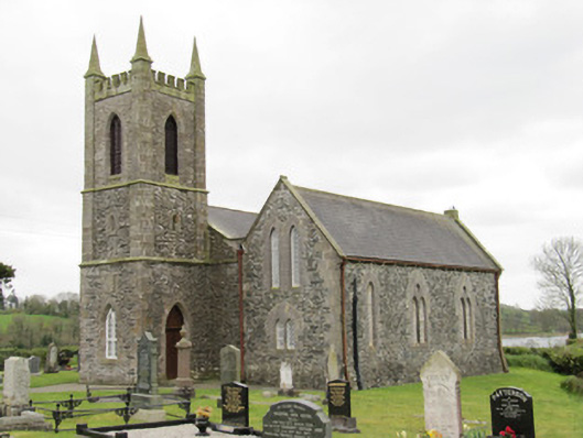 Drum Church (Currin)church/chapel · 141 yd
 Drum Presbyterian Churchchurch/chapel · 259 yd
 Crannog in DunnaluckCrannog · 746 yd
 Fairy fort / earthen ringfort in Aghareagh EastFairy fort / earthen ringfort · 1344 yd
 CortoberMountain / peak · 1.0 mi
 Whitelough PlantationsForest · 1.8 mi
 Brown's HillMountain / peak · 1.8 mi
 Church WoodForest · 2.1 mi
 Bawn in DrumsheilBawn · 2.7 mi
 CastleCastle, unclassified · 3.4 mi
 Giant's GraveArchaeological place · 4.5 mi
 Graveyard in Drumgoon (clankee By.)Graveyard · 5.6 mi
Other information
Photo: Credit not shown in the picture search · Rights wording not checked; contact us if this picture should be removed