What is recorded here
Corduff fort is a circular grass-covered rath on a Monaghan hilltop, its earthen bank reduced to a shallow scarp and its entrance still marked by a farm track. It has stood since at least 1793, when McCrea’s map first drew its lines, and it has watched fields, buildings and forgetting move around it ever since. The fairies may have built it, or people may have built it for fairies to keep out; either way the hill still holds its shape like a remembered promise.
Situated on the summit of a hill. This rath is depicted as an earthwork on McCrea’s map of County Monaghan (1793) and on the 1834 and 1907 editions of the OS 6-inch map. It is a circular grass-covered area (diam. 30.5m) defined by an earthen bank (at N: Wth of base 3.8m; int. H 0.25m; ext. H 1.5m) that is largely reduced to a scarp (H c. 0.75-c. 1.5m) with no visible fosse. There is a farm track at the base of the scarp SSW-NNW connecting with an entrance (Wth of base 1.2m) at NW. It has become overgrown since 1968 and farm buildings impinge on it at W (OSAP, 2005).
The above description is derived from the published 'Archaeological Inventory of County Monaghan' (Dublin: Stationery Office, 1986). In certain instances the entries have been revised and updated in the light of recent research.
Revised by: Michael Moore
Date of revision: 8 May 2018
The monument record does not grant public access. Check the route and ask the landowner before entering private land.
- What survives
- Recorded monument
Places near here
 Man-made underground passage in CrappaghMan-made underground passage · 920 yd
 Aghabog Churchchurch/chapel · 1192 yd
 Crannog in DrumateCrannog · 1210 yd
 Tomb HillMountain / peak · 1396 yd
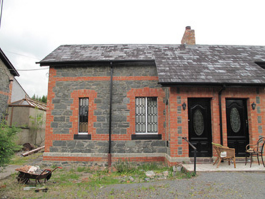 worker's houseworker's house · 1513 yd
 Rabbitburrow WoodWood · 2.9 mi
 Brown Bog WoodForest · 3.1 mi
 Lisarrilly HillMountain / peak · 3.2 mi
 Roosky Castle (Site of)Castle, ringwork · 3.3 mi
 Saint John's WellSpring · 4.4 mi
 Jaundice WellSpring · 5.1 mi
 IndicatedFairy fort / earthen ringfort · 1599 yd
Other information
Photo: Credit not shown in the picture search · Rights wording not checked; contact us if this picture should be removed