What is recorded here
Indicated is a fairy fort or earthen ringfort in Cloonaraher (leyny By.), County Sligo, Ireland. It is the more north-easterly of two conjoined raths in low-lying pasture, enclosing a roughly circular area thirty to thirty-three metres across. A sod-covered stone bank surrounds the site, topped by a stone field boundary grafted onto its inner face and top. Local information identifies this rath as the pen.
In low-lying pasture, on a break of a NE-facing slope. The more north-easterly of the two conjoined raths (SL032-043001-). A roughly circular area (33m NE-SW; 30.5m NW-SE) enclosed by a sod-covered stone bank (Wth 3.5-4m; int. H 1-1.45m; ext. H 1.3m) topped by a stone field boundary. The stone bank appears quite compact S-NE but NE-SE it has a high broad external slump (Wth 4.5m; int. H 1m; ext. H 1.7m). The stone field boundary (Wth 0.7-1m) has been grafted onto the inner face and top of the stone bank, creating a fairly vertical internal face and raising its height by c. 0.3-0.5m. The level interior is slightly lower than exterior ground level along the WSW arc and slightly higher along the ENE arc. According to local information, this rath is known as 'the pen'.
The above description is derived from the published 'Archaeological Inventory of County Sligo' compiled by Ursula Egan, Elizabeth Byrne, Mary Sleeman with Sheila Ronan and Connie Murphy (Dublin Stationery Office, 2005).
Date of upload: 18 January 2008
The monument record does not grant public access. Check the route and ask the landowner before entering private land.
- What survives
- Recorded monument
Places near here
 IndicatedFairy fort / earthen ringfort · 1101 yd
 Carrowmore National Schoolschool · 1255 yd
 Hachured (1838).Fairy fort / earthen ringfort · 1289 yd
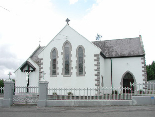 Catholic Church of the Sacred Heartchurch/chapel · 1721 yd
 KnocknasheeMountain / peak · 1.2 mi
 Muckelty HillMountain / peak · 2.3 mi
 CastleCastle, unclassified · 2.4 mi
 The Turf Stack RockNamed rock · 4.1 mi
 European ashEuropean ash · 4.5 mi
 Ballyara Castle (in Ruins)Castle, unclassified · 4.8 mi
 ElderElder · 4.9 mi
 White RockNamed rock · 6.1 mi