What is recorded here
Grave Yard in County Kilkenny is a large, much-frequented burial place beside a 13th-century church, with Clomantagh Castle watching from 130m to the north. People have laid their dead on this gentle slope since at least the late 18th century, and the cut stones uncovered during the 1990s clean-up suggest far more burials than the visible headstones admit. The boundary wall appeared between 1839 and 1900, but the yard itself is older, patient, and still crowded with the forgotten.
On gentle N-facing slope with good views from SSE-S-SW. Clomantagh Castle (KK013-002001-) and bawn (KK013-002002-) are located c. 130m to the N. There are earthworks (KK013-002005-) in the field immediately N of the graveyard (KK013-003002-). A 13th-century church (KK013-003001-) is located close to S boundary wall of the graveyard. According to the OS Letters (1839), there is, ‘a large and much frequented burying ground attached to it’ (O’Flanagan ed. 1930, vol. 1, 161-2 (52-3)). On the 1st (1839) ed. OS 6-inch map the grave yard is indicated by a dashed line which suggests that the boundary was not fixed. By the revised 1900 ed. the graveyard is indicated by a continuous line which suggests the boundary wall had been built between 1839 and 1900. A roughly rectangular graveyard (dims. c. 71m E-W; c. 32m N-S at E end tapering to c. 16m at the W end) with a public road running E-W outside the S boundary. It is entered at the E end of the S wall. The visible headstones date from the late 18th century onwards. Following a clean-up of the graveyard in the 1990s a large number of cut stones (KK013-003003-) were uncovered. Some were kept within the graveyard while others were placed in the adjoining field.
See attached photographs:
KK013-003002-_01 View from NW within graveyard, with W gable of church (KK013-003001-)
KK013-003002-_02 View from NW along N portion of graveyard
KK013-003002-_03 SW portion of graveyard
KK013-003002-_04 Graveyard N of the church (KK013-003001-), from NW
Compiled by: Jean Farrelly
Date of upload: 23 July 2019
The monument record does not grant public access. Check the route and ask the landowner before entering private land.
- What survives
- Recorded monument
Places near here
 Clomantagh Church (in ruins)Church · 13 yd
 Sheela-na-gig in Clomantagh LowerSheela-na-gig · 138 yd
 CastleCastle, tower house · 142 yd
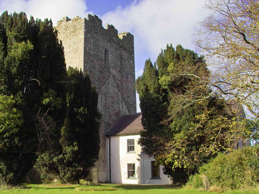 farm housefarm house · 181 yd
 Fairy fort / earthen ringfort in Clomantagh LowerFairy fort / earthen ringfort · 400 yd
 Tubbrid Castle (in ruins)Castle, tower house · 1589 yd
 Clomantagh HillMountain / peak · 1.5 mi
 Kildrinagh WoodForest · 2.2 mi
 John HelyMemorial · 3.3 mi
 DelaneyMemorial · 3.4 mi
 Street fieldArchaeological place · 4.5 mi
 Anker's IslandIsland · 8.1 mi