What is recorded here
Fairy fort / earthen ringfort in Cloghonan is a fairy fort or earthen ringfort in Cloghonan, County Tipperary, Ireland. The site occupies a low-lying, flat pasture area where a roughly circular enclosure still measures 32.7 metres north-south and 36.4 metres east-west. Its denuded bank, outer ditch and second bank remain clearest in the eastern half and at the west, although the centre was levelled decades ago for a bungalow and a remembered stone heap has vanished.
Situated on a flat, level area, relatively low-lying, under pasture. The site was levelled c. 20-30 years ago and a bungalow built directly S of the SE quadrant. The landowner remembers a heap of stones in the centre when he was a boy which may have been the remains of a castle (TN027-149001); the stones are now gone. Present remains consist of a roughly circular area (diam. 32.7m N-S; 36.4m E-W) defined by a very denuded bank (Wth 8m; int. H 0.36m; ext. H 0.21m), outer fosse (Wth 5.6m; D 0.29m) and outer bank (Wth c. 7m), particularly clear in the E half of the site and at W. The OS Letters refer to 'the indistinct ruin of another old castle situated in the southeast corner of an earthen fort. It is said that this is the castle from which the Townland was called Cloch Othanain, the Rock of Othanan, but I think that the real Clock Othanain is the castle which forms a part of the modern Castle Otway' (O'Flanagan 1930, vol. 1, 190).
The above description is derived from 'The Archaeological Inventory of County Tipperary. Vol. 1 - North Tipperary' compiled by Jean Farrelly and Caimin O'Brien (Dublin: Stationery Office, 2002). In certain instances the entries have been revised and updated in the light of recent research.
Date of upload/revision: 22 September 2008
The monument record does not grant public access. Check the route and ask the landowner before entering private land.
- What survives
- Recorded monument
Places near here
 Site of Cloghonan CastleCastle, unclassified · 9 yd
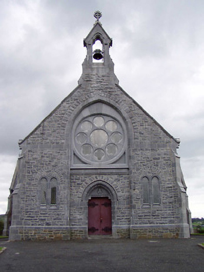 Catholic Church of the Immaculate Conceptionchurch/chapel · 382 yd
 Church in CloghonanChurch · 427 yd
 Castle OtwayCastle, tower house · 591 yd
 IndicatedFairy fort / earthen ringfort · 1695 yd
 Enclosure in Shanballyard (aghnameadle Par.)Enclosure · 1759 yd
 Knockadigeen HillMountain / peak · 1.2 mi
 Ballincurra HillMountain / peak · 1.3 mi
 Killavalla WoodForest · 1.5 mi
 Sweet ChestnutSweet Chestnut · 5.7 mi
 Silvermines ViewpointViewpoint · 6.1 mi
 Our Lady Assumed into HeavenMemorial · 6.6 mi