What is recorded here
Indicated is a fairy fort or earthen ringfort in Carrownacreevy (leyny By.), County Sligo, Ireland. The oval earthwork stands in pasture on a gentle slope, enclosing a slightly raised area with a flat-topped bank and a dry external fosse. Stone wall foundations appear in parts of the bank, while a man-made underground passage cuts through the southwest interior. A disused quarry later dug into the western fosse marks a change in the ancient landscape.
In pasture, on a gentle E-facing slope. A slightly raised oval area (int. diam. 37.5m N-S; 32.5m E-W) enclosed by a mainly flat-topped earthen bank (Wth 6.7m; int. H 0.7m; ext. H 1.7m). A dry external flat-bottomed fosse (Wth 7.3m; D 0.3m) is evident SE-NNW. The foundations of a stone wall on top of the bank are evident in parts. There is an entrance (Wth 3m) at NE. There is a Man-made underground passage (SL032-007002-) in the SW quadrant of the interior. A field boundary extends N from the NNE arc of the rath. A disused quarry, dug into the line of the fosse on the W side was, according to local information, opened in c. 1940.
The above description is derived from the published 'Archaeological Inventory of County Sligo' compiled by Ursula Egan, Elizabeth Byrne, Mary Sleeman with Sheila Ronan and Connie Murphy (Dublin Stationery Office, 2005).
Date of upload: 18 January 2008
The monument record does not grant public access. Check the route and ask the landowner before entering private land.
- What survives
- Recorded monument
Places near here
 IndicatedFairy fort / stone ringfort · 760 yd
 Carrowmore National Schoolschool · 1350 yd
 Enclosure in CarrowmurrayEnclosure · 1456 yd
 KnocknasheeMountain / peak · 1.3 mi
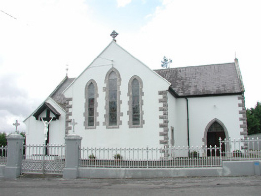 Catholic Church of the Sacred Heartchurch/chapel · 1.7 mi
 CastleCastle, unclassified · 3.0 mi
 Muckelty HillMountain / peak · 3.3 mi
 The Turf Stack RockNamed rock · 3.5 mi
 European ashEuropean ash · 4.6 mi
 ElderElder · 5.1 mi
 White RockNamed rock · 5.4 mi
 Hachured (1838).Fairy fort / earthen ringfort · 1657 yd