What is recorded here
On a gentle E-facing pasture slope c. 200m E of the N-flowing Strade River. According to the Ordnance Survey Letters for Co. Mayo (1838, 361 (148)), ‘At the burying ground is a pointed gateway six and a half feet [c. 1.98m] in height and five feet [c. 1.5m] in breadth’. A rectangular-shaped area (L 40m E-W; Wth 30m N-S) is enclosed by a heavily overgrown stone wall, with no obviously visible entrance. A very poorly preserved and heavily overgrown church (MA070-068001-) stands in the NW corner and the N sidewall and W gable wall of the church form part of the graveyard’s enclosing wall. Some five flat graveslabs and four headstones (one dated 1890) are visible in the interior but the dense overgrowth undoubtedly conceals other grave markers. The first edition of the OS 6-inch map (1837) records a rectangular ‘Vault’ (est. L c. 13m E-W; est. Wth c. 8m) straddling the W wall of the graveyard and abutting the ruined church immediately to its N and its completely overgrown remains survive within the graveyard. Strade Dominican Friary (MA070-067001-) stands c. 225m to the S.
Date of visit: 27-9-2025
Compiled by: Gearóid Conroy
The monument record does not grant public access. Check the route and ask the landowner before entering private land.
- What survives
- Recorded monument
Places near here
 TemplemoreChurch · 15 yd
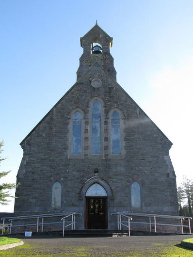 Catholic Church of Saint Peter and Saint Paulchurch/chapel · 178 yd
 Michael DavittMemorial · 262 yd
 IndicatedFairy fort / earthen ringfort · 961 yd
 Ballylahan Castle in RuinsCastle, Anglo-Norman masonry castle · 1.2 mi
 LismoreFairy fort / earthen ringfort · 1.2 mi
 Shonagawna Castle in RuinsCastle, unclassified · 1.9 mi
 Oak WoodWood · 4.0 mi
 Admiral William BrownMemorial · 4.1 mi
 Foxford Woollen MillsHeritage attraction · 4.1 mi
 National Museum of Ireland, Country LifeMuseum · 4.2 mi
 Sunken GardenWood · 4.3 mi