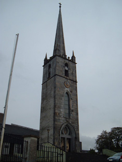
What is recorded here
Attached three-stage square-plan tower and spire, dated 1847, attached by glazed corridor to replacement church, built c. 1980. Ribbed limestone spire with carved limestone cross finial, pinnacles to corners and castellated parapet. Ashlar limestone to front elevation and all elevations of third stage, having string course between upper stages, with painted roughcast rendered walls to remaining elevations. Inset date plaque and applied clock to front elevation. Tower openings comprising pointed arch window openings with chamfered surrounds, having stained glass and limestone hood-moulding to second stage. Pointed arch carved limestone door surround with hood-moulding, tympanum having stained-glass octofoil flanked by stained-glass sidelights set over pair of square-headed chamfered door openings with paired timber battened doors having cast-iron door furniture, approached by flight of cut limestone steps. Present, recent, church has curved ten-bay entrance front and four-bay nave elevations, with single-pitched artificial slate roof and roughcast rendered walls.
This imposing tower is all that remains of the original Church of the Immaculate Conception, which was built in 1847 and demolished in 1978 and replaced by the present building. The tower is situated on an elevated site and can be seen from almost any point in the town. It displays many fine features such as the timber battened doors with cast-iron door furniture, and finely executed stonework.
This does not grant access. Most recorded buildings are privately owned; view them only from public ground unless the owner allows entry.
Places near here
 Catholic ChurchChurch · 26 yd
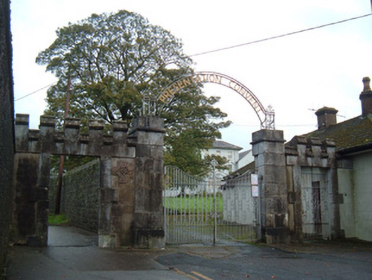 Presentation Conventgates/railings/walls · 104 yd
 John MandevilleMemorial · 225 yd
 Mitchelstown Town MapVisitor information · 225 yd
 Statue of Saint FanahanMemorial · 381 yd
 Grave YardGraveyard · 593 yd
 St Finnchus WellHoly well · 753 yd
 White Knights Tower (Site of)Castle, unclassified · 1184 yd
 Carriganoura Castle (in Ruins)Castle, tower house · 2.4 mi
 FlagCave · 3.0 mi
 Skeheen MountainMountain / peak · 3.1 mi
 Ballyarthur HillMountain / peak · 3.6 mi
Other information
Photo: National Inventory of Architectural Heritage · Website use allowed for educational or private purposes with source credit