What is recorded here
Lisnamoe is a worn oval ringfort in Mid Cork pasture, its low eastern bank once swallowed by field fences while a sharper scarp still marks the western edge. Cattle graze where people may have lived, trampling the soil until the fort became a subtle ripple rather than a wall. The land has forgotten its own boundary, yet the shape remains large enough to suggest that someone once drew a circle around their life and called it home.
In pasture, at base of E-facing slope. Oval area (c. 80m N-S; 70m E-W) defined by low worn bank on E side; scarp (max. H 1.25m) elsewhere. Bank to NE and E formerly incorporated into field fence system (Hartnett 1939, 296). Interior under pasture; according to Hartnett (ibid.) 'fort has been tilled'. Surrounding field fences removed.
The above description is derived from the published 'Archaeological Inventory of County Cork. Volume 3: Mid Cork' (Dublin: Stationery Office, 1997). In certain instances the entries have been revised and updated in the light of recent research.
Date of upload/revision: 14 January 2009
Lisnamoe, Bellmount Upper is an oval-shaped early-medieval ringfort, likely dating to between the 6th and 10th centuries AD, characterized by a low bank on its eastern side and a scarp up to 1.25m high. While no specific folklore is recorded for this site, like many such forts in Ireland, it may have been associated with local legends of fairies or ancient inhabitants in folk tradition.
The monument record does not grant public access. Check the route and ask the landowner before entering private land.
- What survives
- Recorded monument
Places near here
 IndicatedKiln, lime · 1169 yd
 Clodah CastleCastle · 1172 yd
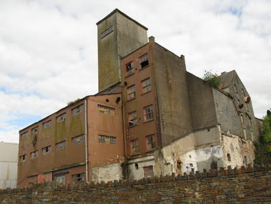 Bellmount Millsmill (water) · 1176 yd
 Enclosure in ClodahEnclosure · 1208 yd
 Michael Collins MemorialMemorial · 1.5 mi
 Castlemore CastleCastle · 1.9 mi
 Independence MuseumMuseum · 2.2 mi
 Kilmurry WoodsPicnic place · 2.5 mi
 Pedunculate OakPedunculate Oak · 2.6 mi
 Priest MemorialMemorial · 2.7 mi
 Andrew's WoodWood · 3.0 mi