What is recorded here
Grave Yard at Rockmills, County Cork, holds late 18th and 19th-century headstones beside low uninscribed markers, still receiving the occasional burial. Its stone wall climbs a retaining wall on the roadside, while the Church of Ireland tower rises above the older parish church of St Nathlash. The dead have crowded this narrow rectangle for generations, naming some and leaving others to the soil.
On SW side of road; at NW end of Rockmills. Rectangular graveyard (c. 35m NE-SW; c. 50m NW-SE); enclosed by stone wall except for roadside on NE side where it is enclosed by stone wall atop retaining wall. Headstones date mainly from late 18th and 19th-century: a number of low uninscribed grave markers also noted. Still in occasional use. Tower and steeple of C of I church (14701) on N side. Site of earlier parish church of St Nathlash (14397).
The above description is derived from the published 'Archaeological Inventory of County Cork. Volume 4: North Cork' (Dublin: Stationery Office, 2000). In certain instances the entries have been revised and updated in the light of recent research.
Date of upload/revision: 14 January 2009
The monument record does not grant public access. Check the route and ask the landowner before entering private land.
- What survives
- Recorded monument
Places near here
 Church in BallyvoddyChurch · 6 yd
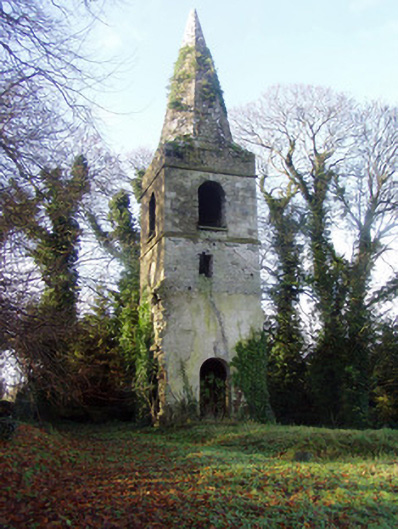 Saint Nathlash Church of Ireland Churchchurch/chapel · 14 yd
 WeirWeir, regulating · 460 yd
 Flat cemetery in Ballyenahan NorthFlat cemetery · 1575 yd
 Carrigdownane Castle (in Ruins)Castle, Anglo-Norman masonry castle · 1638 yd
 Man-made underground passageMan-made underground passage · 1.2 mi
 Derryvillane Castle (in Ruins)Castle, unclassified · 1.3 mi
 North Meadow WoodForest · 2.8 mi
 Horse Field WoodForest · 2.8 mi
 Anne's Grove GardensHeritage attraction · 2.9 mi
 Graveyard in BoherashGraveyard · 3.4 mi
 St Dominick's WellSpring · 3.4 mi