What is recorded here
This tall stone stands on a NW facing slope overlooking the Anascaul valley. It is 3.9m high and measures 1.1m x .78m at base; E-W.
An ogham inscription occurs on the ENE angle, commencing .4m above present ground level. Natural weathering and the use of the stone as a scratching post by cattle have damaged the inscription in parts, and when first recorded by Pelham (1804, 224-5), some of the scores were considered 'too faint to be delineated'. However, Macalister (1945, 157-8) gives the reading:
VOENACUNAS M....
Neither the first 2 scores of the first N, nor the S or M are traceable today, although there is sufficient space to accomodate the relevant scores. A large spall has been detached above this removing the remainder of the inscription; Macalister presumes this was deliberately carried out to 'de-paganise' the monument. A simple Latin cross with slightly expanded terminals to head and arms has been carved on the SE face, about 1.03m above the ground. There is little doubt that this was a prehistoric standing stone to which the inscription and cross were added at a later time.
The above description is derived from J. Cuppage, ‘Corca Dhuibhne. Dingle Peninsula archaeological survey. Ballyferriter. Oidhreacht Chorca Dhuibhne’ (1986), no. 77. In certain instances the entries have been revised and updated in the light of recent research.
Date of upload: 3 August 2013
The monument record does not grant public access. Check the route and ask the landowner before entering private land.
- What survives
- Recorded monument
Places near here
 Hut site in FarranalickeenHut site · 400 yd
 Man-made underground passage in BallintermonMan-made underground passage · 491 yd
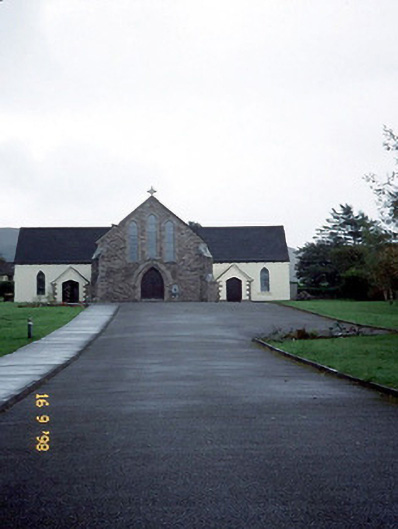 Catholic Church of the Sacred Heartchurch/chapel · 1538 yd
 Brackloon Lodgehotel · 1581 yd
 Statue of Our LadyHeritage attraction · 1.2 mi
 Jerome ConnorMemorial · 1.2 mi
 BrickanyMountain / peak · 1.3 mi
 Bunaneer StrandBeach / strand · 1.5 mi
 Graveyard in BallynacourtyGraveyard · 2.0 mi
 EmlaghMountain / peak · 3.4 mi
 Glanteenassig Forest ParkForest · 3.5 mi
 Acres PointHeadland · 3.5 mi