What is recorded here
Fifty metres north of the ruined Emlygrennan Church, a ghost circle appears and vanishes depending on when the sky looks down. Airlift cameras caught a platform in 1968 and cropmarks revealed a twenty-metre ring decades later, yet boot-soled feet find only smooth pasture. The land keeps its own calendar, giving up shape to altitude and hunger while withholding it from human hands.
In pasture, Emlygrennan Church ruins (LI048-015001-) and graveyard (LI048-015002-) lie 50m to S. Not marked on historic OSi maps. Trace of enclosure or platform visible to the N of Emlygrennan Church on oblique aerial photograph taken 17/07/1968 (CUCAP BGK052). Possible trace of levelled earthwork visible as a circular cropmark (diam. c. 20m) on OSi orthophotograph taken between 2005-2012. No surface remains visible on Google Earth orthoimages.
See attached oblique aerial photograph taken 17/07/1971 (CUCAP BGK052) and Google Earth orthoimages.
Compiled by: Fiona Rooney
Date of upload: 6 August 2021
The monument record does not grant public access. Check the route and ask the landowner before entering private land.
- What survives
- Recorded monument
Places near here
 Stone GravesCist · 53 yd
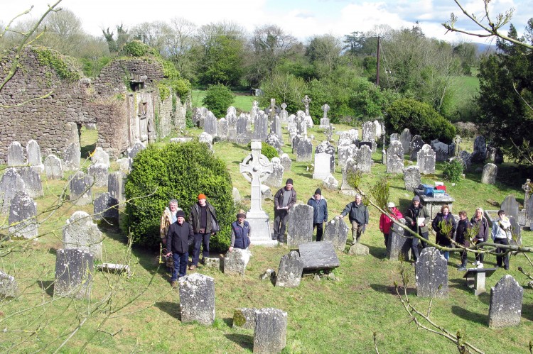 Grave YardGraveyard · 85 yd
 Ballynahinch Bridgebridge · 1385 yd
 Ballinvreena LoopVisitor information · 1.0 mi
 Knocktoran Housegate lodge · 1.2 mi
 Athneasy FortCastle, motte and bailey · 1.6 mi
 Edmund's WellSpring · 1.7 mi
 SlievereaghMountain / peak · 2.6 mi
 Castle (in ruins)Castle, tower house · 2.7 mi
 St Patrick's WellSpring · 2.8 mi
 Ballyhoura tourist informationVisitor information · 3.0 mi
 Palatine's RockNamed rock · 3.1 mi