
What is recorded here
The fairy fort or earthen ringfort in Ballincurra is in County Westmeath, Ireland. Situated on a low natural rise in gently undulating pasture, the monument is visible as a roughly circular-shaped tree-planted area on Digital Globe aerial photography. It was depicted on the 1837 edition of the Ordnance Survey six-inch map as a subcircular-shaped tree-planted area and on the revised 1913 edition of the Ordnance Survey twenty-five-inch map as a roughly oval-shaped tree-planted area. A 1979 description identified it as a possible ringfort enclosed by the remains of a substantial earthen bank with a wide shallow external fosse and a possible entrance gap at the southwest.
Situated on a low natural rise, in gently undulating pasture, with good views in all directions. Ballincurra House located 380m to WSW. The monument is visible as a roughly circular-shaped tree-planted area on Digital Globe aerial photography. Depicted on the 1837 ed. OS 6-inch map as a subcircular-shaped tree-planted area. Depicted on the revised 1913 ed. OS 25-inch map as a roughly oval-shaped tree-planted area (approx. dims. 32m NE-SW; 27m NW-SE). Earthwork not depicted as an antiquity on any ed. OS 6-inch map and is located on the demesne lands of Ballincurra House. The monument may have been a ringfort that was converted into a tree-ring in the post-1700 period as part of the landscaping of the demesne lands of Ballincurra House. Alternatively the enclosure could be a tree-ring of post-1700 date.
Possible ringfort described in 1979 as the remains of a subcircular-shaped area (dims. 29m E-W; 27m N-S) enclosed by the remains of a substantial earthen bank with wide shallow external fosse and possible entrance gap (Wth 3.8m) at SW. The enclosing bank has been reduced to a scarp from W-N and from E-S. A wide gap at NE appears to be due to disturbance. No definite trace of habitation visible within the interior.
A site description from 1980 adds that this is a roughly circular-shaped area defined by a bank which is reduced to a scarp. The scarp has the remains of external stone facing, but notes that this may not be an original feature. A gap at NE appears to have a slight causeway across the fosse, however this is difficult to define as it has been defaced by cattle. Two large stones have been dumped into the fosse at NE. The interior is slightly uneven & there are faint traces of broad cultivation ridges (long-axis NE-SW). There are the low remains of old cultivation ridges (long-axis c. N-S) in the field surrounding the monument.
Compiled by: Alison McQueen, Vera Rahilly and Caimin O’Brien
Date of upload: 03 December 2018
The monument record does not grant public access. Check the route and ask the landowner before entering private land.
- What survives
- Recorded monument
Places near here
 OutlinedFairy fort / earthen ringfort · 617 yd
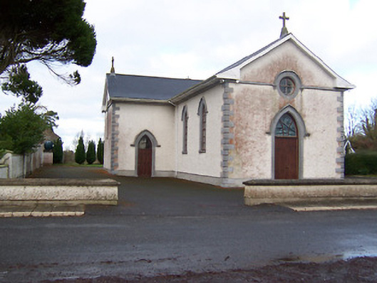 Saint Patrick's Catholic Churchchurch/chapel · 730 yd
 gates/railings/wallsgates/railings/walls · 1183 yd
 Partially hachuredFairy fort / earthen ringfort · 1677 yd
 Site of CastleCastle, unclassified · 1.9 mi
 Sessile OakSessile Oak · 1.9 mi
 Hachured, 420 ODCastle, motte · 2.2 mi
 Ancient Ring FortWood · 3.1 mi
 Abbeyshrule AbbeyRuins · 3.3 mi
 Craft WorkshopHeritage attraction · 4.1 mi
 Guest ServicesVisitor information · 4.2 mi
 Goldsmith Birthplace, PallasVisitor information · 4.4 mi
Other information
Photo: Credit not shown in the picture search · Rights wording not checked; contact us if this picture should be removed