What is recorded here
A small graveyard enclosed by a stone wall sits on the southern edge of a narrow east-west valley in County Kildare, and what makes it quietly remarkable is not the graves themselves but the layers of purpose that have accumulated around it over centuries. An old laneway just to the north of the enclosure may itself have formed part of that route, worn into the ground by generations of people walking east towards the valley of the two lakes. Roughly 150 metres to the east-south-east lies Toberkevin, a holy well, the name invoking St Kevin himself and reinforcing the sense that this corner of Kildare was once understood as part of a sacred corridor leading towards Glendalough.
To the E of and outside the medieval town of Athy (KD035-022----). Formerly a rectangular area (est. c. 60m N-S; c. 40m E-W) surrounding St. Michael’s parish church (KD035-022014-), but extended significantly to W and N in modern times. The earliest legible gravemarkers date from the 18th-century.
Compiled by: Gearóid Conroy
Date of upload: 11 December 2013
The monument record does not grant public access. Check the route and ask the landowner before entering private land.
- What survives
- Recorded monument
Places near here
 St Michaels Church (in Ruins)Church · 10 yd
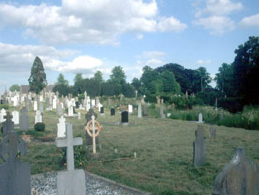 Saint Michael's Old Cemeterygraveyard/cemetery · 19 yd
 Athy War MemorialMemorial · 57 yd
 Zoltan Zinn-Collis memorialMemorial · 330 yd
 Town HallMuseum · 586 yd
 Whites [sic] Castle, Police BarrackCastle, tower house · 659 yd
 Enclosure in PrusselstownEnclosure · 1054 yd
 Woodstock CastleRuins · 1092 yd
 Enclosure in ArdrewEnclosure · 1308 yd
 Scots PineScots Pine · 1.7 mi
 Inch WoodForest · 3.0 mi
 History of Moat of ArdscullVisitor information · 3.3 mi