What is recorded here
Ten thousand years of rain erased the stones but left a shadow in the soil. The oval marks a boundary drawn before written history, yet it still holds its shape beneath the grass. Violet Hill watches from above, proud and new, while the old enclosure waits patient and nameless.
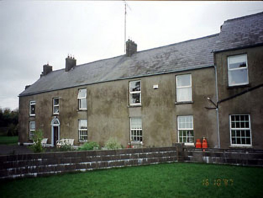
Situated on a slight W-facing slope c. 100m from the steep slope down (H c. 10m) to a SE-NW section of the River Boyne, and on land that was on the demesne of Violet Hill, originally a small Georgian house of c. 1790 (buildingsofireland.ie 14010044) that is c. 150m to the NNW. The cropmark of an oval enclosure (dims c. 30m NW-SE; c. 22m NE-SW) defined by a single fosse, with possible quarries on the perimeter at NE and S, is visible on OSI images (1995) and on Google Earth (14/07/2018). There are possible entrances at N and S but no internal features are visible. Although it is in an area that was archaeologically tested (02E1178) by E. O’Donovan (excavations.ie 2002:1421), trenching did not extend to this area. It was first reported by Steven McGlade.
See the attached enhanced view from OSI images (1995)
Compiled by: Michael Moore
Date of upload: 4 October 2021
The monument record does not grant public access. Check the route and ask the landowner before entering private land.
- What survives
- Recorded monument
Places near here
 Saint Joseph's Convent of Mercyhouse · 157 yd
 unknownunknown · 209 yd
 CastleCastle, motte · 209 yd
 The RampartWood · 756 yd
 CrossCross, Wayside cross (present location) · 854 yd
 Field boundary in AthlumneyField boundary · 905 yd
 Nangle CourtMemorial · 1.4 mi
 Blackcastle DemesneWood · 1.5 mi
 Donaghmore Round TowerHeritage attraction · 1.6 mi
 Carn HillMountain / peak · 2.1 mi
 Rathaldron Ho.Castle, tower house · 2.3 mi
 BohermeenMountain / peak · 4.1 mi
Other information
Photo: Credit not shown in the picture search · Rights wording not checked; contact us if this picture should be removed