What is recorded here
The following description is derived from the published 'Archaeological Inventory of County Meath' (Dublin: Stationery Office, 1987). In certain instances the entries have been revised and updated in the light of recent research.
Date of upload/revision: 10 July 2007
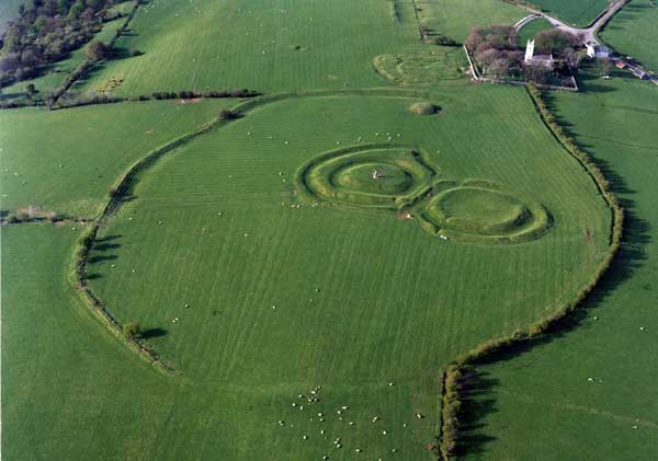
Oval area, defined by earthen bank with internal fosse SSE-NE and elsewhere by field fence (dims. c. 310m NNE-SSW, c. 210m ESE-WNW). No original entrances detected. (MacAlister 1931, 19. 20)
The monument record does not grant public access. Check the route and ask the landowner before entering private land.
- What survives
- Recorded monument
Places near here
 Ráith na RíoghArchaeological place · 9 yd
 Lia FailStanding stone (present location) · 34 yd
 Battle of Tara (Ireland)Major battlefield · 111 yd
 Battle of Tara Hillbattle · 112 yd
 St. Patricks ChurchChurch · 264 yd
 Hill of Tara Visitor Centrechurch/chapel · 286 yd
 Saint Patrick'sMemorial · 319 yd
 Tara Open StudioGallery · 340 yd
 Hill of TaraVisitor information · 439 yd
 CrockaphobbieWood · 1.2 mi
 CastleCastle, tower house · 1.3 mi
 Clusker Wood NorthWood · 1.4 mi