What is recorded here
Mortons and the Brehon laws, Cahens and the lordship of Donegal, O'Neills and the Ulster plantations, O'Donnells and the ancient kingship, Norman knights and Anglo-Irish parliaments, all left marks in Ulster. Rath vowels and Derry consonants still argue inside one mouth. Ulster is not a region in the usual sense. It is a collision chamber where every border was drawn, broken, redrawn and forgotten.
The official Northern Ireland record identifies this as RATH. Recorded period: E.CHRIST.. The official map point was placed at the centre of the recorded archaeological site from the source map reference.
The monument record does not grant public access. Check the route and ask the landowner before entering private land.
- What survives
- Recorded monument
Places near here
 CropmarkCropmark, Possible enclosure · 996 yd
 Dromore ViaductHeritage attraction · 1.0 mi
 ENCLOSURE in BallygowanENCLOSURE · 1.0 mi
 Methodist ChurchChurch · 1.2 mi
 Cathedral Church of Christ the RedeemerChurch · 1.2 mi
 TOWER-HOUSE: DROMORE CASTLE in DromoreTOWER-HOUSE: DROMORE CASTLE · 1.2 mi
 Dromore CastleCastle · 1.2 mi
 War MemorialMemorial · 1.3 mi
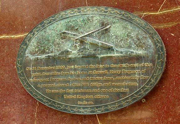 Harry FergusonMemorial · 4.2 mi
 Hillsborough FortVisitor information · 4.3 mi
 Lake TrailWalking route · 4.3 mi
 Hillsborough Forest ParkForest · 4.5 mi