
What is recorded here
In a D-shaped graveyard immediately SW of the modern RC church in Aughrim village. Marked on 1st ed. of OS 6-inch map as a roofed L-shaped building, labelled 'R.C. Chapel', its principal axis aligned NNW-SSE. What survives are the poorly preserved and recently conserved ruins of a rectangular building (NE-SW; L c. 24m, Wth c. 8m), possibly partly medieval in date. Only SW gable survives to full height though short lengths of adjoining NW and SE side-walls also stand. There is a pointed arch doorway close to S end of NW wall, framed by a moulded architrave; this now functions as the entrance to the graveyard. The surviving gable is substantial; a series of putlog holes are visible externally and internally, and a plain rectangular window indicates that there were two storeys at SW end. The modern graveyard wall is built on the line of NW wall which, along with the other walls, survives only as foundations. The fabric of the gable, when coupled with the dedication of the adjacent holy well, raises the possibility that this is the remains of a medieval parish church or the Augustinian priory (GA087-067----), later incorporated into an RC Church. A holy well (GA087-053004-) lies 70m to SE. (Egan 1960, 29)
The above description is derived from the published 'Archaeological Inventory of County Galway Vol. II - North Galway'. Compiled by Olive Alcock, Kathy de hÓra and Paul Gosling (Dublin: Stationery Office, 1999).
Date of upload: 05 August 2010
The monument record does not grant public access. Check the route and ask the landowner before entering private land.
- What survives
- Recorded monument
Places near here
 St. Catherines WellHoly well · 79 yd
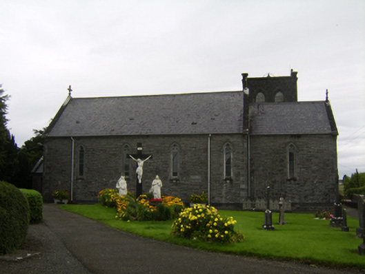 Saint Catherine's Catholic Churchchurch/chapel · 124 yd
 Battle of Aughrim Interpretative CentreMuseum · 170 yd
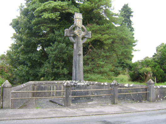 Patrick Hogan Monumentmonument · 303 yd
 Field system in AttidermotField system · 329 yd
 Castle (Site of)Castle, Anglo-Norman masonry castle · 349 yd
 Battle of AughrimMajor battlefield · 1219 yd
 Oak WoodWood · 1520 yd
 The bloody HollowHeritage attraction · 1644 yd
 Urraghry HillMountain / peak · 1.6 mi
 West WoodWood · 2.5 mi
 Ballagh Castle (in Ruins)Castle, unclassified · 2.8 mi
Other information
Photo: Credit not shown in the picture search · Rights wording not checked; contact us if this picture should be removed