What is recorded here
In an overgrown hollow in pastureland. Named 'Pollnaveagh Well' on the 1838 and 1922 editions of the OS 6-inch maps in Roman script. This well lies underground and a pump house, now disused, has been built above it. The well shaft (diam. c. 2.5m) tapered sharply towards the bottom and was lined with mortared stone. A flight of shallow steps at ESE led down to a narrow pointed opening (Wth 0.65m; H 2.45m), which was surmounted by a medieval two-light ogee-headed window fragment (GA113-117001-) and a plain roughly hewn stone cross with a round base. There was a small mortared recess outside the well, near the base of the N side of the steps. Its function was unclear and it had been disturbed. Korff and O'Connell (1985) noted that the well was known locally as ‘St. Matthew’s Well’. However, based on its location within the estate of the Mahon family, of Northampton House, who built a number of follies (see GA113-172----, GA113, 182---- and GA113-202----) on their lands, Gosling (1987, 9-10) has suggested that it too may be a folly.
1. Gosling P. 1987 ‘The Follies at Northampton’, Trácht Magazine, 9-10.
2. Korff, A. and O'Connell, J. 1985 Kinvara: a rambler's map and guide. Kinvarra.
Galway Archaeological Survey, UCG
Date of upload: 9 May 2023
Pollnaveagh Well is associated with Saint Kevin, a 6th-century Irish monk and founder of Glendalough, and is traditionally believed to have curative properties, particularly for eye ailments. The name "Pollnaveagh" is derived from the Irish "Poll na bhFiach," meaning "well of the foxes," referencing local folklore that foxes once guarded the sacred site.
The monument record does not grant public access. Check the route and ask the landowner before entering private land.
- What survives
- Recorded monument
Places near here
 IndicatedFairy fort / stone ringfort · 450 yd
 farm housefarm house · 827 yd
 CaveMan-made underground passage · 1121 yd
 Dungory Castle (in ruins)Castle, tower house · 1.5 mi
 Dunguaire CastleCastle · 1.5 mi
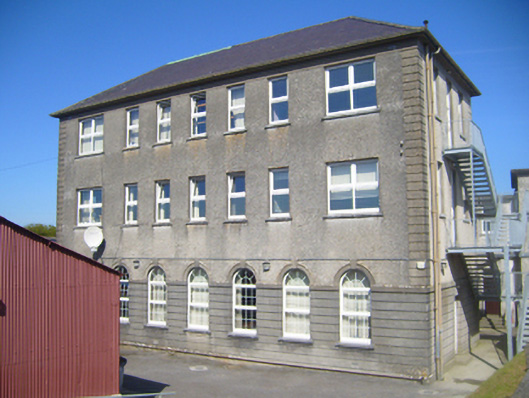 Seamount Collegehouse · 1.5 mi
 Mulroney's IslandIslet · 2.6 mi
 Cusheen IslandIslet · 2.9 mi
 Coole-Garryland Nature ReserveNature reserve · 3.3 mi
 European BeechEuropean Beech · 3.6 mi
 Grave of Saint Mac Duagh's ServantArchaeological place · 4.5 mi
 Traught BeachBeach / strand · 4.6 mi