
What is recorded here
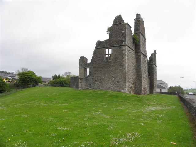
An unknown hand carved the bawn and built the house after the middle ages ended, forcing a new way of living into County Tyrone. The stones may have marked a boundary between old customs and incoming power, yet no named owner or exact date remains behind that claim. A person may have stood at its edge, measuring whether obedience or memory would survive the new wall.
The official Northern Ireland record identifies this as PLANTATION HOUSE & BAWN. Recorded period: POST-MED. The official map point was placed at the centre of the recorded archaeological site from the source map reference.
The monument record does not grant public access. Check the route and ask the landowner before entering private land.
- What survives
- Recorded monument
Places near here
 ENCLOSURE in CavanakeeranENCLOSURE · 1616 yd
 Pomeroy ForestForest · 1.0 mi
 ENCLOSURE in CorrycroarENCLOSURE · 1.1 mi
 Captain Stewart's HillMountain / peak · 2.5 mi
 Giant's GraveArchaeological place · 2.8 mi
 Sandholes Presbyterian ChurchChurch · 4.7 mi
 Drum Manor Forest ParkWood · 5.1 mi
 Wellbrook Beetling MillHeritage attraction · 5.5 mi
 Kildress Old ChurchRuins · 5.5 mi
 C17th HOUSE & BAWN, possibly on site of earlier fort: CASTLE CAULFIELD in Lisnamonaghan, CastlecaufieldC17th HOUSE & BAWN, possibly on site of earlier fort: CASTLE CAULFIELD · 5.8 mi
 CastlecaufieldCastle · 5.8 mi
 Parkanaur Forest ParkHeritage attraction · 6.1 mi
Other information
Photo: Credit not shown in the picture search · Rights wording not checked; contact us if this picture should be removed