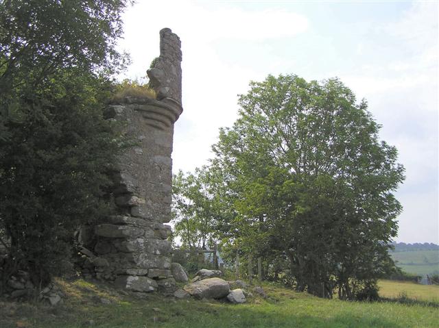
What is recorded here
Mountcastle rises in County Tyrone as a post-medieval plantation castle, its stones scheduled for protection long after the builders left. It is not a vague ruin but a recorded castle landscape, large enough to mark on a map and distinct enough to keep separate from ordinary field walls. That much is clear. What is missing is the life that filled it: whether it was a residence, a guard post, a tax office or a family seat; whether its rooms were warm or empty; whether people loved it, feared it or simply passed it on the way to market.
The official Northern Ireland record identifies this as PLANTATION CASTLE: MOUNT CASTLE. Recorded period: POST-MED. Recorded protection: Scheduled. The official map point was placed at the centre of the recorded archaeological site from the source map reference.
Built during the 17th century as part of the English Plantation of Ulster, Mount Castle was held by settlers established under James I's colonial policy. It is remembered as a symbol of the post-medieval colonization and anglicization of Ireland.
The monument record does not grant public access. Check the route and ask the landowner before entering private land.
- What survives
- Recorded monument
Places near here
 Glencush BridgeBridge · 764 yd
 Ballynabwee FortArchaeological place · 949 yd
 ENCLOSURE in MoyaghENCLOSURE · 1280 yd
 Donemana Presbyterian ChurchChurch · 2.0 mi
 Dunnamanagh CastleRuins · 2.1 mi
 Gortmonly HillMountain / peak · 2.2 mi
 SlievekirkMountain / peak · 2.9 mi
 BATTLE SITE: BATTLE OF THE FORDS, Northern crossing, 1689 in Ballydonaghy; Greenlaw; LeckpatrickBATTLE SITE: BATTLE OF THE FORDS, Northern crossing, 1689 · 3.8 mi
 Round WoodWood · 3.9 mi
 Ballee WoodWood · 4.1 mi
 Altinaghree CastleCastle · 4.1 mi
 Chambered GraveArchaeological place · 4.9 mi
Other information
Photo: Kenneth Allen · CC BY-SA 2.0