What is recorded here
The Well of St Brendan's Anointing (KE078-005001-) is located on a small rock-knoll towards the centre of Emlagh Bog, Valencia Island, and overlooks the Atlantic just 400m to N. It comprises a holy well, a cross-slab, three stone crosses and a number of miscellaneous features, including a possible leacht.
Leacht (KE078-005008-): Henry noted the existence of some upright slabs E of the knoll (1957, 92). These were described by both Westropp and Macartney Robbins (1912, 301; 1942), and appear to be the remains of a leacht which measured 17 feet (5.2m) NE-SW x 10 feet (3m) NW-SE. This may be the 'Penitential Station' noted at the site on the second edition of the OS map.
The above description is derived from A. O'Sullivan and J. Sheehan (compilers), 'The Iveragh peninsula: an archaeological survey of South Kerry'. Cork University Press (1996), no. 939. In certain instances the entries have been revised and updated in the light of recent research.
Date of upload: 30 July 2013
Linked to St Brendan the Navigator, the well is traditionally associated with healing and penitential practices, reflecting the saint’s widespread cult in early Irish Christianity. The cross-slab and location on a prominent natural feature suggest its use as a site for pilgrimage and ritual cleansing.
The monument record does not grant public access. Check the route and ask the landowner before entering private land.
- What survives
- Recorded monument
Places near here
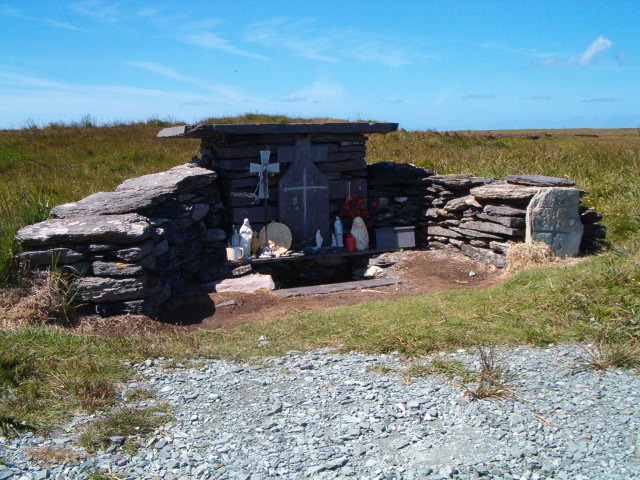 Tobar Olla BrenainnHoly well · 17 yd
 RoadRoad, road/trackway · 95 yd
 Hut site in BrayHut site · 441 yd
 Culloo RockViewpoint · 746 yd
 Telegraph Field Valentia IslandMemorial · 1.2 mi
 Cromwell's FortRuins · 1.4 mi
 Bray HeadMountain / peak · 1.6 mi
 ValentiaIsland · 1.7 mi
 Horse IslandIslet · 1.9 mi
 Skellig Experience CentreMuseum · 1.9 mi
 Fogher CliffCliff · 2.1 mi
 GeokaunMountain / peak · 2.4 mi